Werrimull facts for kids
Quick facts for kids WerrimullVictoria |
|||||||||||||||
|---|---|---|---|---|---|---|---|---|---|---|---|---|---|---|---|

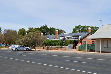
Werrimull Hotel
|
|||||||||||||||
| Population | 97 (2021 census) | ||||||||||||||
| Postcode(s) | 3496 | ||||||||||||||
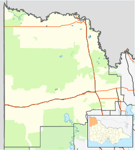
| Location | |||||||||||||||
| LGA(s) | Rural City of Mildura | ||||||||||||||
| Region | Sunraysia | ||||||||||||||
| State electorate(s) | Mildura | ||||||||||||||
| Federal Division(s) | Mallee | ||||||||||||||
|
|||||||||||||||
Werrimull is a small town in Victoria, Australia. It's part of the Rural City of Mildura. You can find it about 10 kilometers west of Karawinna and 10 kilometers east of Bambill.
Werrimull is also about 79 kilometers west of Mildura. It's located 13 kilometers south of the Sturt Highway, near Lake Cullulleraine. In 2016, Werrimull and the areas around it had a population of 112 people.
The name Werrimull comes from an Indigenous Australian word. It is thought to mean "Eagle." Sometimes, people might misspell it as Werrimul. This might happen because it sounds like the name of an Indigenous group from the Horsham area.
Contents
A Look at Werrimull's Past
The Millewa region, where Werrimull is located, started to be used for farming in the 1920s. Werrimull's Post Office first opened its doors on June 24, 1924. A railway line reached Werrimull in 1923 and officially opened in 1924. However, the railway closed down by 1989.
Many native Eucalyptus trees in the area were cut down to make space for farms. This clearing of trees has led to a problem called soil salinity in the region. Soil salinity means the soil has too much salt, which can make it hard for plants to grow.
Soldier Settlements in the Area
Most of the Werrimull area was part of a Soldier Settlement program. After World War I, land was given to soldiers returning from the war. These land blocks were about one square mile (2.6 square kilometers) in size. However, many people found these blocks too small to make enough money from farming. Because of this, many families found it hard to make a living in this region. The number of people living in the Millewa area has been slowly going down for many years.
Towns That Used to Be Here
The Werrimull area used to have several other small towns or communities. These places had their own post offices when more people lived there. Some of these past communities include:
- Bambill: Its post office was open from 1926 to 1959.
- Bambill South: This place had a post office from 1928 to 1930.
- Karawinna: Its post office was open from 1924 to 1970.
- Karawinna North: This was on the Sturt Highway and had a post office from 1928 to 1951.
- Yarrara: Its post office was open from 1926 to 1978.
- Yarrara North: This was also located on the Sturt Highway.
Werrimull Today
The main way people make a living in Werrimull and the Millewa region is through farming. Farmers here grow different types of grains, like wheat, barley, and oats. There is also a lot of sheep and cattle farming in the area.
Werrimull is also a place where a few tourists stop. They often visit the Millewa Pioneer Forest, which is a natural area nearby.
Sports and Education
Werrimull has an Australian rules football team. This team plays in the Millewa Football League. The team was very strong in the 1920s and 1970s. Their most recent championship win was in 2013.
The main school in the Millewa region is the Werrimull P-12 School. This school teaches students from age 5 all the way up to 18 years old.
 | Bayard Rustin |
 | Jeannette Carter |
 | Jeremiah A. Brown |


