White Bird Hill Summit facts for kids
Quick facts for kids White Bird Hill Summit |
|
|---|---|
| Elevation | 4,245 ft (1,294 m) |
| Traversed by | |
| Location | Idaho County, Idaho, U.S. |
| Range | Clearwater Mountains |
| Coordinates | 45°50′38″N 116°14′13″W / 45.844°N 116.237°W |
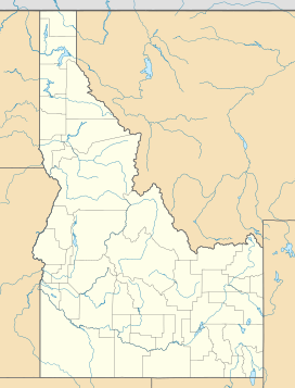
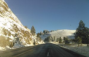
White Bird Hill Summit is a high point on a road in Idaho, in the northwestern United States. It's like a special spot where U.S. Highway 95 crosses over a mountain. This summit is in Idaho County, right between the towns of White Bird and Grangeville. The highest part of the highway here is 4,245 feet (about 1,294 meters) above sea level. This high point was made by cutting through the earth.
Contents
White Bird Hill Summit: A High Road in Idaho
Building the Modern Road
The road you see today, with many lanes, was finished in 1975. It took ten years to build! The project ended when a bridge over White Bird Creek opened in June 1975.
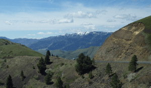
When you drive north, the road goes up a lot. It climbs about 2,700 feet (823 meters) over 7 miles (11 kilometers). This means it's a very steep climb, with an average slope of over 7%. There are no trees on this part of the road.
A Look Back: The Old Road
The very first road was built a long time ago, starting in 1918. It was finished in 1921 and first paved in 1938. This old road was about 22 miles (35 kilometers) long. It went from the Salmon River to Grangeville.
The old road was even higher than the new one, reaching 4,429 feet (1,350 meters). This was because there was no cut through the mountain at the top. The old road was also twice as long and had many sharp turns, called switchbacks. It went up a treeless hill, just like the new road's northbound climb.
History and Nature
White Bird Hill Summit is an important place. It marks the boundary between the Salmon River valley and the Camas Prairie. The Salmon River is a big river in Idaho. The Camas Prairie is a large, flat area of land.
A famous event from history happened near here. The Battle of White Bird Canyon took place in the valley south of the summit in 1877. This battle was part of the Nez Perce War. The summit is named after Chief White Bird, who was a leader of the Nez Perce tribe.
Thinking About Other Paths
Even in the 1950s, people thought about different ways to build the road. One idea from 1952 was to avoid the summit and Grangeville completely. This plan suggested continuing along the lower Salmon River for another 15 miles (24 kilometers). Then, the road would climb up Rock Creek to Graves Creek, leading to the town of Cottonwood.
 | Jackie Robinson |
 | Jack Johnson |
 | Althea Gibson |
 | Arthur Ashe |
 | Muhammad Ali |


