White Oak, Missouri facts for kids
Quick facts for kids
White Oak, Missouri
|
|
|---|---|

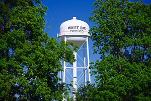
Water tower in White Oak
|
|

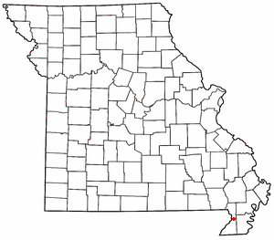
Location of White Oak in Missouri
|
|
| Country | United States |
| State | Missouri |
| County | Dunklin |
| Area | |
| • Total | 0.13 sq mi (0.33 km2) |
| • Land | 0.13 sq mi (0.33 km2) |
| • Water | 0.00 sq mi (0.00 km2) |
| Elevation | 272 ft (83 m) |
| Population
(2020)
|
|
| • Total | 101 |
| • Density | 801.59/sq mi (309.76/km2) |
| FIPS code | 29-79468 |
| GNIS feature ID | 2806398 |
White Oak is a small, unincorporated community located in Dunklin County, Missouri, in the United States. An unincorporated community means it's a place where people live together, but it doesn't have its own local government like a city or town. White Oak is situated along Route 25, about five miles north of the town of Kennett.
Contents
History of White Oak
White Oak got its start a long time ago. A post office was opened in the community in 1891. The name "White Oak" comes from a group of large white oak trees that grew near the place where the first buildings were built. In 1895, the name of the post office was slightly changed to "Whiteoak."
Understanding the Population
What are Demographics?
Demographics is a way to study the people who live in a certain area. It helps us understand how many people are there, how old they are, and other interesting facts. This information is often collected by a government count called a census.
White Oak's Population Count
The most recent count of people in White Oak was done during the 2020 United States Census. This official count showed that 101 people lived in White Oak at that time. Knowing the population helps us understand the size and changes happening in the community.
| Historical population | |||
|---|---|---|---|
| Census | Pop. | %± | |
| 2020 | 101 | — | |
| U.S. Decennial Census | |||
 | Emma Amos |
 | Edward Mitchell Bannister |
 | Larry D. Alexander |
 | Ernie Barnes |

