Whitesboro, Oklahoma facts for kids
Quick facts for kids
Whitesboro, Oklahoma
|
|
|---|---|
| Country | United States |
| State | Oklahoma |
| County | Le Flore |
| Area | |
| • Total | 3.28 sq mi (8.49 km2) |
| • Land | 3.27 sq mi (8.48 km2) |
| • Water | 0.00 sq mi (0.00 km2) |
| Elevation | 689 ft (210 m) |
| Population
(2020)
|
|
| • Total | 172 |
| • Density | 52.52/sq mi (20.28/km2) |
| Time zone | UTC-6 (Central (CST)) |
| • Summer (DST) | UTC-5 (CDT) |
| ZIP code |
74577
|
| FIPS code | 40-80900 |
| GNIS feature ID | 2629941 |
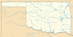
Whitesboro is a small community located in Le Flore County, Oklahoma, United States. It is known as a census-designated place (CDP). A CDP is an area that the government counts for population and statistics, but it does not have its own local government like a city or town.
History of Whitesboro
The first post office in Whitesboro opened a long time ago, on April 14, 1902. The community was named after an early settler in the area, a man named Paul White.
When Whitesboro was first established, it was part of a larger area called Wade County. This county was a section of the Apukshunnubbee District within the Choctaw Nation. The Choctaw Nation is a Native American tribe that historically lived in this region.
Population and People
This section tells us about the number of people living in Whitesboro. This information comes from official counts called censuses.
How Many People Live Here?
The most recent count, from the 2020 census, showed that 172 people live in Whitesboro.
| Historical population | |||
|---|---|---|---|
| Census | Pop. | %± | |
| 2020 | 172 | — | |
| U.S. Decennial Census | |||
See also
 In Spanish: Whitesboro (Oklahoma) para niños
 | Mary Eliza Mahoney |
 | Susie King Taylor |
 | Ida Gray |
 | Eliza Ann Grier |


