Wicomico River (Potomac River tributary) facts for kids
Quick facts for kids Wicomico River |
|
|---|---|

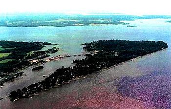
Cobb Island, MD is at the junction of Neale Sound, Wicomico River, and the Potomac River
|
|
| Country | United States |
| State | Maryland |
| Physical characteristics | |
| River mouth | Potomac River 0 feet (0 m) |
| Length | 13.0 miles (20.9 km) |
The Wicomico River is a 13.0-mile-long (20.9 km) river in Maryland, United States. It flows into the Potomac River. A tributary is a smaller stream or river that flows into a larger one. The Wicomico River is special because its lower part is tidal. This means its water level changes with the ocean's tides, just like a bay or the ocean itself.
The river meets the Potomac River near Cobb Island and St. Margaret's Island. The land area that drains water into the Wicomico River is called its watershed. This watershed covers about 77 square miles (200 km2) across Charles, St. Mary's, and southern Prince George's counties. Part of the river even forms the border between Charles and St. Mary's counties.
In 1968, the Wicomico River was named a "Scenic River" by Maryland. This means it's recognized for its natural beauty and importance. Special groups called Scenic River Commissions help protect the river in both Charles and St. Mary's counties.
Exploring the Wicomico River's Branches
The Wicomico River has many smaller streams and creeks that flow into it. These are also called tributaries. They help carry water from the surrounding land into the main river. Knowing these branches helps us understand the river system better.
Main Tributaries of Wicomico River
- Allens Fresh Run
- Willmer Creek
- Cramer Gut
- Posey Creek
- Tears Gut
- Steinhauser Gut
- Bunker Hill Branch
- Foggy Bottoms Gut
- Colby Run
- Newport Marsh Run
- Newport Run
- Hickory Gut
- St. Clair Gut
- Murphy Run
- Hodister Run
- Lloyd Drain
- Bowling Gut
- Budds Creek
- Chaptico Bay
- Chaptico Run
- Burroughs Run
- Bull Run
- Maddox Creek
- Charleston Creek
- Neale Sound
 | Jewel Prestage |
 | Ella Baker |
 | Fannie Lou Hamer |

