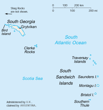
Willis Islands facts for kids

South Georgia and South Sandwich Islands
|
|
| Geography | |
|---|---|
| Location | South Atlantic Ocean |
| Coordinates | 54°0′S 38°11′W / 54.000°S 38.183°W |
| Administration | |
|
United Kingdom
|
|
The Willis Islands are a small group of islands. They are located west of South Georgia Island. These islands are part of the South Georgia Islands.
They are about 3.2 kilometers (2 miles) west of Bird Island. The Stewart Strait separates them. Captain James Cook found them on January 14, 1775. He named them after Thomas Willis. Thomas was a sailor on Cook's ship. He was the first to see the islands. Later, between 1926 and 1930, people from the Discovery Investigations explored them more. They gave names to each island.
Contents
Geography
The Willis Islands are made up of a main island and many smaller rocks and islands.
Main Island
The biggest island in the group is called Main Island. It is about 2.7 kilometers (1.7 miles) long. It is also about 550 meters (1,800 feet) high. This makes it the most important island in the group.
The southwestern tip of Main Island is called Johannesen Point. It was once called "All Johannesens Point." This name was too long. So, it was shortened to Johannesen Point.
Islands and Rocks West of Main Island
Several named rocks and groups of rocks are located west of Main Island.
Acorn Rock
Acorn Rock is a rock that rises 20 meters (66 feet) above the sea. It is about 0.56 kilometers (0.35 miles) northwest of Main Island. It was given its name because it looks like an acorn.
Holgate Shoal
Holgate Shoal is an area of shallow water. It is about 2.8 kilometers (1.5 nautical miles) northwest of Main Island. This shoal was named after Ralph A. Holgate. He was a sailor who helped map the area in 1961.
Tiger Rocks
A pair of rocks called the Tiger Rocks are found about 2.8 kilometers (1.5 nautical miles) west of Main Island. They are southwest of Holgate Shoal. They were given a descriptive name, likely because of their appearance.
Ramp Rocks
The westernmost point of the Willis Islands is a group of three bare rocks. They are called the Ramp Rocks. They are about 4.6 kilometers (2.5 nautical miles) northwest of Johannesen Point. The largest rock was once called laavebrua by Norwegian whalers. This means "threshing floor ramp." The name was changed to Ramp Rocks to avoid confusion with another island.
Bryde Rocks
About 1.9 kilometers (1 nautical mile) west-southwest of Main Island's south end are the Bryde Rocks. This small group of rocks was named after Thorleif Bryde. He was a gunner for a whaling company.
Pugh Shoal
Pugh Shoal is another area of shallow water. It is about 2.8 kilometers (1.5 nautical miles) south of Main Island. It was named after Peter J. Pugh. He was a sailor who helped map this shoal in 1961.
Islands East of Main Island
There are several islands located to the east of Main Island.
Heron Passage
Heron Passage is a channel that separates Main Island from Vaughan Island. Vaughan Island is close to the east. Trinity Island is about 1.1 kilometers (0.7 miles) to the northeast. This passage was named after the Heron. This was a small boat used for surveying the area.
Vaughan Island
Vaughan Island is a small, cone-shaped island. It is covered in tussock grass. It is located close to the east of Main Island. It was named after Lieutenant Commander Hugh L.F. Vaughan. He was an officer on the ship that surveyed the area.
Trinity Island
Trinity Island is much larger than Vaughan Island. It was named "Trinity" because it has three peaks.
Verdant Islands
To the southeast of Trinity Island are two small islands. They are covered in tussock grass. They were first called "Verdant Island." This name means "green and lush." In 1985, the name was changed to "Verdant Islands" because there were actually two islands.
Hall Island
East of the Verdant Islands is Hall Island. It is small, steep, and covered in tussock grass. It was named after Commander Geoffrey P.D. Hall. He was the commanding officer of the ship that surveyed the area.
Proud Island
The easternmost island in the group is Proud Island. It is a small but relatively high island. It is covered in tussock grass. It has a peak at its northern end. It was named "Proud" because in naval terms, "standing proud" means "sticking up."
Fauna
The Willis Islands are a very important place for Antarctic fur seals. Many fur seals come here to breed and have their pups.
See also
 In Spanish: Islas Willis para niños
 | Sharif Bey |
 | Hale Woodruff |
 | Richmond Barthé |
 | Purvis Young |

