Wilson Range facts for kids
Quick facts for kids Wilson Range |
|
|---|---|
| Highest point | |
| Elevation | 7,119 ft (2,170 m) |
| Geography | |
| Country | United States |
| State | Montana |
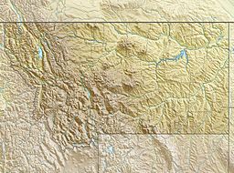
The Wilson Range is a small group of mountains located in the northeastern part of Glacier National Park (U.S.) in Glacier County, Montana. These mountains stand about 7,119 feet (2,170 m) tall at their highest point. They run alongside the border between the United States and Canada.
The range was named after Lieutenant Charles William Wilson. He was an important person who helped map the border between Canada and the United States many years ago.
Where is the Wilson Range?
The Wilson Range is found inside Glacier National Park. This park is famous for its amazing mountains, forests, and lakes. It is located in the state of Montana, right next to the Canadian border. The Wilson Range is a smaller part of this huge, beautiful park. It sits in the very northeast corner of the park, making it one of the first mountain groups you might see if you were coming from Canada.
What is Glacier National Park?
Glacier National Park is a large protected area in Montana. It is known for its tall mountains, deep valleys, and many glaciers. It is a popular place for hiking, wildlife watching, and exploring nature. The park is home to many animals, including grizzly bears, moose, and mountain goats.
Who Was Charles William Wilson?
The Wilson Range is named after Lieutenant Charles William Wilson. He was a British officer who lived from 1836 to 1905. He worked as a secretary for the British Boundary Commission. This group was responsible for mapping and marking the exact border between Canada and the United States. This work happened between 1858 and 1862. Naming the mountains after him was a way to honor his important work in mapping the region.
 | William M. Jackson |
 | Juan E. Gilbert |
 | Neil deGrasse Tyson |


