Wingan Inlet facts for kids
Quick facts for kids Wingan Inlet |
|
|---|---|

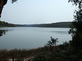
A view of the inlet from a walking track to the beach.
|
|
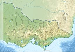
| Location | East Gippsland, Victoria |
| Coordinates | 37°44′21″S 149°30′14″E / 37.73917°S 149.50389°E |
| Type | Inlet |
| Primary inflows | Wingan River |
| Primary outflows | Tasman Sea |
| Basin countries | Australia |
| Managing agency | Parks Victoria |
| Surface area | 38 hectares (94 acres) |
Wingan Inlet is a beautiful inlet located within the Croajingolong National Park. You can find it in the East Gippsland area of Victoria, Australia. An inlet is a small arm of the sea, a lake, or a river that reaches inland.
Contents
Exploring Wingan Inlet
Wingan Inlet covers an area of about 38 hectares (that's like 94 football fields!). The Wingan River flows into it, and its waters eventually flow out into the Tasman Sea.
Getting There and Camping
Getting to Wingan Inlet is an adventure! It's about an hour's drive from the nearby town of Cann River. The road is unsealed, so it can be a bit bumpy. Once you arrive, you'll find a camping ground managed by park rangers. It's a great spot for a nature getaway.
Wildlife and Nature
The area around Wingan Inlet is full of amazing wildlife. You might spot many kinds of marine life, like crabs and Sydney rock oysters. There are also lots of birds and small mammals living here. It's important to be aware of local wildlife such as Lace monitors and snakes.
The Wingan Point headland is a piece of land that sticks out into the sea. It's located very close to where the inlet meets the ocean.
A Glimpse into History
Wingan Inlet has an interesting past, especially concerning its earliest inhabitants and European explorers.
First Peoples of the Land
The traditional owners of the land around Wingan Inlet are the Australian Aboriginal Bidhawal and Nindi-Ngudjam Ngarigu Monero peoples. They have lived on and cared for this land for thousands of years.
European Exploration
- Captain Cook's Visit: The famous explorer James Cook noted Wingan Inlet on his maps back in 1770. He even named a nearby southern headland "Ram Head."
- George Bass's Adventure: In 1798, another explorer named George Bass found shelter near the inlet during a storm. He was on a journey in a small boat called the Elizabeth. He was trying to reach a shipwreck, but bad weather made him turn back.
- Searching for Shelter: Wingan Inlet was the only safe place for a small boat to hide from the rough seas in that area. Bass called a nearby sheltered bay "Fly Cove."
- A Lost Anchor: Bass's group even lost an anchor in Fly Cove! Later, on his way back, he stopped to look for it but couldn't find it.
- Discovering Bass Strait: Even though Bass didn't reach the shipwreck, his journey was very important. He noticed how the tides changed along the coast. This made him believe there was a strait (a narrow waterway) separating mainland Australia from Tasmania. This idea was later proven true when he and Mathew Flinders sailed around Tasmania in 1798–99. This waterway is now known as Bass Strait.
 | Anna J. Cooper |
 | Mary McLeod Bethune |
 | Lillie Mae Bradford |


