Yapacaní facts for kids
Quick facts for kids
Yapacaní
Villa Yapacaní
|
|
|---|---|
|
Town
|
|
 |
|
| Country | |
| Department | |
| Province | Ichilo |
| Founded | August 23, 1953 |
| Elevation | 296 m (971 ft) |
| Population
(2012)
|
|
| • Total | 26,270 |
| Time zone | UTC-4 (BOT) |
| Climate | Am |
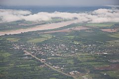
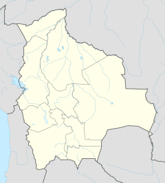
Yapacaní (also known as Villa Yapacaní) is a major city in the Ichilo Province of Bolivia. It is part of the Santa Cruz department. The city sits on the west bank of the Yapacani River, where the Surutú River joins it. It is about 100 kilometers (62 miles) northwest of Santa Cruz de la Sierra, which is Bolivia's largest city. Yapacaní is the main center for the Yapacaní Municipio district. Before the city was officially founded on August 23, 1953, there was a military outpost called El Comando in the area.
In 1963, the road from Montero to the west ended at the Yapacaní River. Building a bridge was very difficult back then. People had to cross the river by boat to reach Villa Busch, which was an administrative camp. If the river was too high, crossings could be delayed for several days. Traveling from Villa Busch into the colony was often done on foot because vehicles would get stuck.
The number of people living in Yapacaní has grown a lot. In 1992, there were 8,585 residents. By 2001, the population increased to 14,665. The latest estimate from 2012 shows that about 26,270 people live there now.
Contents
What is the Geography of Yapacaní Like?
Yapacaní is in the wettest part of the Santa Cruz department. It is located where different types of forests meet. These include the tropical mountain rainforests of Amboró and Carrasco, the Amazon rainforests of the Chapare region, and the flat, rainy plains of western Santa Cruz and southwestern Beni.
What is the Climate in Yapacaní?
Even though Yapacaní has a short dry season, it rains a lot throughout the year. Temperatures are usually warm to hot. The area has a tropical monsoon climate, which is very close to a tropical rainforest climate. This is based on the Köppen Climate Classification System.
| Climate data for Yapacaní | |||||||||||||
|---|---|---|---|---|---|---|---|---|---|---|---|---|---|
| Month | Jan | Feb | Mar | Apr | May | Jun | Jul | Aug | Sep | Oct | Nov | Dec | Year |
| Record high °C (°F) | 38.1 (100.6) |
37.8 (100.0) |
39.3 (102.7) |
38.0 (100.4) |
34.0 (93.2) |
32.2 (90.0) |
32.0 (89.6) |
35.0 (95.0) |
36.4 (97.5) |
38.4 (101.1) |
40.3 (104.5) |
38.4 (101.1) |
40.3 (104.5) |
| Mean daily maximum °C (°F) | 30.2 (86.4) |
30.5 (86.9) |
29.5 (85.1) |
27.7 (81.9) |
24.9 (76.8) |
23.1 (73.6) |
23.9 (75.0) |
27.7 (81.9) |
29.4 (84.9) |
29.8 (85.6) |
30.7 (87.3) |
31.4 (88.5) |
28.2 (82.8) |
| Daily mean °C (°F) | 26.8 (80.2) |
26.6 (79.9) |
26.2 (79.2) |
24.7 (76.5) |
22.8 (73.0) |
20.4 (68.7) |
21.1 (70.0) |
23.0 (73.4) |
25.2 (77.4) |
26.4 (79.5) |
27.1 (80.8) |
27.0 (80.6) |
24.8 (76.6) |
| Mean daily minimum °C (°F) | 21.3 (70.3) |
21.3 (70.3) |
20.5 (68.9) |
18.9 (66.0) |
16.5 (61.7) |
15.4 (59.7) |
14.8 (58.6) |
16.3 (61.3) |
18.7 (65.7) |
19.8 (67.6) |
20.3 (68.5) |
20.9 (69.6) |
18.7 (65.7) |
| Record low °C (°F) | 20.4 (68.7) |
19.0 (66.2) |
19.0 (66.2) |
17.5 (63.5) |
15.0 (59.0) |
11.0 (51.8) |
10.0 (50.0) |
14.4 (57.9) |
16.7 (62.1) |
18.0 (64.4) |
18.3 (64.9) |
19.0 (66.2) |
10.0 (50.0) |
| Average precipitation mm (inches) | 444.4 (17.50) |
467.5 (18.41) |
242.1 (9.53) |
242.8 (9.56) |
129.0 (5.08) |
116.7 (4.59) |
55.6 (2.19) |
59.0 (2.32) |
158.2 (6.23) |
193.0 (7.60) |
244.3 (9.62) |
368.2 (14.50) |
2,720.7 (107.11) |
| Average precipitation days (≥ 1.0 mm) | 14.0 | 11.1 | 12.7 | 9.4 | 11.4 | 3.4 | 1.0 | 4.0 | 5.6 | 7.4 | 9.4 | 11.9 | 111.6 |
| Average relative humidity (%) | 79 | 79 | 79 | 78 | 79 | 78 | 73 | 65 | 64 | 67 | 72 | 77 | 74 |
| Source: SENAMHI | |||||||||||||
How Do People Get Around in Yapacaní?
The center of Yapacaní has a four-lane road. This road was repaved in 2010, and new stop lights were added. Most people in Yapacaní travel using motorcycles, small shared cars called "truffies," and micro-buses.
What are the Local Transportation Options?
Motorcycle taxis are very common on the city streets. You can ride one from one place to another for about 2 Bolivianos. For traveling between towns, people usually use truffies. These are cars operated by groups that share the route.
How Much Does it Cost to Travel?
A trip to Santa Cruz costs 20 Bolivianos. Traveling to Montero is 10 Bolivianos. A ride to Santa Fe costs 2 Bolivianos, and to San Juan de Yapacani it's 4 Bolivianos. Going to Bulo Bulo costs 11 Bolivianos. There is also one bus that goes directly from Yapacaní to Cochabamba.
What is the Economy of Yapacaní Like?
The small villages around Yapacaní grow many different crops. These include rice, sugarcane, mandarin oranges, and other products. Rice is the biggest crop grown here. It provides income for many small communities north of the town.
How Do Farmers Access Their Fields?
These communities are reached by a road called "Faja Norte." There is a small fee of two Bolivianos to enter this road. The Faja Norte road forms a loop. It goes northwest from Yapacaní and then rejoins the main Santa Cruz-Cochabamba road near the community of Ichilo. Most of this road is gravel, and it can be hard to drive on during the rainy season.
Which Communities Produce Rice?
The towns along the Faja Norte that grow rice, from closest to farthest from Yapacaní, are: Km 7, Villa Imperial (Km 23), El Comandito (Km 35), Km 48, Challavito, and Cascabel. There is also a natural gas facility at the north end of the road loop. Near this facility are two communities called Los Pozos and Patajusal.
Are There Natural Events in Yapacaní?
Yapacaní is located in an area between the Andes Mountains and the Brazilian Shield. This region is usually not very active with earthquakes. However, it does have the potential for them.
When Was the Last Earthquake?
The most recent earthquake in the area happened on January 23, 2010. It was a magnitude 5.3 earthquake. The earthquake occurred about 10 miles southeast of the town. No injuries or damage were reported in the center of Yapacaní.
See also
 In Spanish: Villa Yapacaní para niños
 | Misty Copeland |
 | Raven Wilkinson |
 | Debra Austin |
 | Aesha Ash |


