Yapacaní River facts for kids
Quick facts for kids Yapacaní River |
|
|---|---|
| Country | Bolivia |
| Physical characteristics | |
| Main source | Santa Cruz Department 292 m (958 ft) |
| Length | 335 km (208 mi) |
| Basin features | |
| Basin size | Amazon Basin |

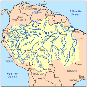
The Yapacaní River is an important river in Bolivia. It is part of the huge Amazon River system, which is one of the largest river systems in the world. This river is about 335 kilometers (208 miles) long. It flows north through the Santa Cruz Department. The Yapacaní River eventually joins the Mamoré River, which then flows into the Rio Grande.
Contents
Where the Yapacaní River Flows
The Yapacaní River starts in the beautiful Amboró National Park. It gets its water from many smaller rivers and streams. The river officially begins where two other rivers, the Yapacaní and the Surutú, meet. This meeting point is located at 17°24′35″S 63°50′33″W.
From there, the river flows mostly northwest. It continues its journey until it reaches its mouth in the Rio Grande. This point is located at 15°58′25″S 64°31′00″W.
River Borders and Flooding
The Yapacaní River forms a natural border between two areas: the municipalities of San Juan and Yapacaní. These areas are both in the Ichilo Province of the Santa Cruz Department.
Sometimes, the river can become very wide, up to 800 meters (2,600 feet) in some places. This can cause flooding, which threatens towns like La Chancadora that are located close to the river. To help control the water, work began in 2005 to channel parts of the Yapacaní-Surutú river system. The Piray River is another important river that flows into the Yapacaní.
Why the Yapacaní River is Important
The Yapacaní River is important for a few reasons, especially for the people living nearby.
Fishing and Food
The river is a good place for fishing. Many types of fish live in its waters, which can be caught and sold. This provides food and income for local communities.
Agriculture and Farming
For many years, the land along the river banks has been used for farming. People clear the land to grow crops. This started in the Santa Cruz Department around 1954.
In the past, crossing the Yapacaní River was difficult. Before bridges were built, people had to cross by boat. If the river was high, crossings could be delayed for several days. This made it hard for farmers to transport their goods. In 1966, construction began on a bridge over the river. This bridge made it much easier and safer for people to cross and travel.
See also
 In Spanish: Río Yapacaní para niños
Sources
 | Toni Morrison |
 | Barack Obama |
 | Martin Luther King Jr. |
 | Ralph Bunche |

