Yarmouth, Iowa facts for kids
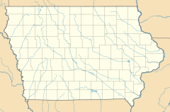
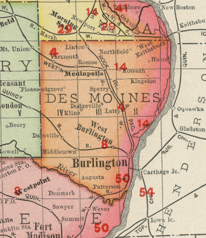
Yarmouth is a small community in Iowa, United States. It's called an "unincorporated community" because it doesn't have its own local government like a city or town. It's located in the northwestern part of Des Moines County.
Quick facts for kids
Yarmouth, Iowa
|
|
|---|---|
| Country | United States |
| State | Iowa |
| County | Des Moines |
| Area | |
| • Total | 1.71 sq mi (4.43 km2) |
| • Land | 1.71 sq mi (4.43 km2) |
| • Water | 0.00 sq mi (0.00 km2) |
| Population
(2020)
|
|
| • Total | 61 |
| • Density | 35.65/sq mi (13.76/km2) |
| Time zone | UTC-6 (Central (CST)) |
| • Summer (DST) | UTC-5 (CDT) |
| ZIP code |
52660
|
| Area code(s) | 319 |
| FIPS code | 19-87330 |
History of Yarmouth
Yarmouth began to grow in 1876. A man named Andrew C. Kline arrived and opened a general store. A general store sells many different kinds of goods. Around the same time, a blacksmith also started a business. A blacksmith makes and repairs things out of metal.
In 1881, the Burlington and Northwestern Railway came to Yarmouth. The local post office, which was about a mile away, moved to Yarmouth and was renamed. By 1885, nearly 100 people lived in the village. It had three general stores, a drug store, a blacksmith shop, and a billiard hall. There were also two churches.
By 1897, Yarmouth had a stock yard near the train tracks. A stock yard is a place where livestock (like cows or pigs) are kept. There were also two grain elevators, which are tall buildings for storing grain. The Starker Brother's Lumber Yard and Corn Cribs were also there. The post office was across from a bank. The community had Baptist and Methodist Episcopal churches and about 20 houses.
In 1902, Yarmouth's population was 55 people. By 1905, a Masonic lodge called Federal Lodge No. 445 was active. A Masonic lodge is a meeting place for a social and charitable organization. The Mutual Telephone Company of Yarmouth also started providing phone service.
Geography of Yarmouth
Yarmouth is located on a wide, low ridge. This ridge is a special type of landform called a terminal moraine. It was formed by a very old ice sheet, or glacier, during the Illinoian glaciation. This was a time when large parts of the Earth were covered in ice.
The land to the west of Yarmouth is older than the glacier. The land to the east of the ridge was formed by the glacier. When scientists drilled wells in Yarmouth, they found an old soil layer. This layer was on top of the older land and buried under the glacier's deposits. This ancient soil layer was named the Yarmouth paleosol. For a time, the period when this soil formed was called the Yarmouth interglacial.
205th Avenue runs through Yarmouth from north to south. It is part of Des Moines County Highway X31. This road is about 810 feet (247 meters) above sea level.
Population in Yarmouth
| Historical population | |||
|---|---|---|---|
| Census | Pop. | %± | |
| 2020 | 61 | — | |
| U.S. Decennial Census | |||
This section shows how many people live in Yarmouth. According to the 2020 United States Census, 61 people lived in Yarmouth. The U.S. Decennial Census counts the population every ten years.
 | John T. Biggers |
 | Thomas Blackshear |
 | Mark Bradford |
 | Beverly Buchanan |


