
Zapote facts for kids
Quick facts for kids
Zapote
|
|
|---|---|
|
District
|
|

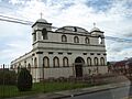
Catholic Church of Zapote located across the street from Parque Nicaragua, the district's main park.
|
|

Zapote
Location in Costa Rica
|
|
| Country | |
| Province | San José |
| Canton | San José |
| Area | |
| • Total | 2.87 km2 (1.11 sq mi) |
| Elevation | 1,176 m (3,858 ft) |
| Population
(2011)
|
|
| • Total | 18,679 |
| • Density | 6,508/km2 (16,857/sq mi) |
| Time zone | UTC−06:00 |
| Postal code |
10105
|
Zapote is a district in Costa Rica. It's the fifth district of the San José canton, located in the San José province. Think of a district as a neighborhood or a part of a larger city area. Zapote is one of the areas surrounding downtown San José.
This district is mostly a place where people live. However, it also has some important government buildings. The most famous one is the Presidential House. This is where the government of Costa Rica works.
Contents
What's in a Name?
The Meaning of Zapote
The name Zapote comes from a type of tree. This tree is called a sapote tree. It's known for its tasty fruits. In Spanish, the word for this tree and its fruit is "zapote."
Where is Zapote?
Geography and Location
Zapote covers an area of about 2.87 square kilometers. It sits at an elevation of 1176 meters above sea level. This means it's quite high up!
The district is located on the eastern side of the San José canton. It shares borders with other areas. To the north, it borders the Montes de Oca Canton. To the east, it borders the Curridabat Canton. Zapote also borders the San Francisco district to the south. To the west, it borders the Catedral district.
Who Lives in Zapote?
Population Facts
| Historical population | |||
|---|---|---|---|
| Census | Pop. | %± | |
| 1864 | 773 | — | |
| 1883 | 773 | 0.0% | |
| 1892 | 994 | 28.6% | |
| 1927 | 1,711 | 72.1% | |
| 1950 | 6,895 | 303.0% | |
| 1963 | 12,769 | 85.2% | |
| 1973 | 17,311 | 35.6% | |
| 1984 | 18,504 | 6.9% | |
| 2000 | 20,753 | 12.2% | |
| 2011 | 18,679 | −10.0% | |
|
Instituto Nacional de Estadística y Censos |
|||
According to the 2011 census, Zapote had a population of 18,679 people. This number helps us understand how many people call Zapote home.
Getting Around Zapote
Road Connections
Several important roads pass through Zapote. These roads help people travel in and out of the district. They connect Zapote to other parts of Costa Rica.
 National Route 39
 National Route 204
 National Route 215
Neighborhoods and Important Buildings
Exploring Zapote's Areas
Zapote district is made up of many smaller areas called "barrios" or neighborhoods. Some of these include Alborada, Calderón Muñoz, Cerrito, Córdoba, and Gloria. You can also find Jardín, Las Luisas, Mangos, Montealegre, and Moreno Cañas. Other neighborhoods are Quesada Durán, San Dimas, San Gerardo (part of it), Trébol, Ujarrás, Vista Hermosa, Yoses Sur, and Zapote Centro.
The most important building in Zapote is the Casa Presidencial. This building is the official workplace for the President of Costa Rica. It's where the president and the executive branch of the government make important decisions for the country. The Presidential House has been located here since 1986.
Images for kids
-
Catholic Church of Zapote located across the street from Parque Nicaragua, the district's main park.
See also
 In Spanish: Zapote (Costa Rica) para niños
