Zwischenwasser facts for kids
Quick facts for kids
Zwischenwasser
|
||
|---|---|---|
 |
||
|
||

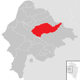
Location within Feldkirch district
|
||
| Country | Austria | |
| State | Vorarlberg | |
| District | Feldkirch | |
| Area | ||
| • Total | 22.63 km2 (8.74 sq mi) | |
| Elevation | 525 m (1,722 ft) | |
| Time zone | UTC+1 (CET) | |
| • Summer (DST) | UTC+2 (CEST) | |
| Postal code |
6835
|
|
| Website | http://www.zwischenwasser.at | |
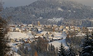
Zwischenwasser is a small and friendly community located in the beautiful state of Vorarlberg, Austria. It is part of the Feldkirch district. This area is known for its stunning natural beauty, nestled among mountains and green landscapes. Zwischenwasser is made up of three main parts: Muntlix, which is the largest, along with Batschuns and Dafins.
Contents
What is Zwischenwasser Like?
Zwischenwasser is a municipality, which is a bit like a town or a local government area. It covers about 22.63 square kilometers (about 8.7 square miles). The community is located at an elevation of 525 meters (about 1,722 feet) above sea level. This means it's in a hilly or mountainous region, offering great views and outdoor activities.
The name "Zwischenwasser" means "between waters." This likely refers to its location between different streams or rivers in the area. It is a peaceful place where people can enjoy nature and a quiet lifestyle.
Parts of Zwischenwasser
Zwischenwasser is divided into three main villages or districts. These are:
- Muntlix: This is the biggest part of Zwischenwasser. It often serves as the main center for the community.
- Batschuns: A smaller, charming village within the municipality.
- Dafins: Another part of Zwischenwasser, known for its quiet and scenic surroundings.
These parts together form the community of Zwischenwasser, each contributing to its unique character.
Who Leads Zwischenwasser?
Like any town or city, Zwischenwasser has a leader. The person in charge is called the Mayor. The current mayor of Zwischenwasser is Kilian Tschabrun. The mayor helps make decisions about the community, like managing local services and planning for the future.
How Many People Live Here?
The number of people living in Zwischenwasser has changed a lot over the years. In 1869, there were only 854 people. By 2018, the population had grown to 3,252 people. This shows that more and more people have chosen to live in this lovely area over time.
| Historical population | ||
|---|---|---|
| Year | Pop. | ±% |
| 1869 | 854 | — |
| 1880 | 920 | +7.7% |
| 1890 | 939 | +2.1% |
| 1900 | 983 | +4.7% |
| 1910 | 984 | +0.1% |
| 1923 | 971 | −1.3% |
| 1934 | 1,135 | +16.9% |
| 1939 | 1,109 | −2.3% |
| 1951 | 1,363 | +22.9% |
| 1961 | 1,671 | +22.6% |
| 1971 | 2,329 | +39.4% |
| 1981 | 2,552 | +9.6% |
| 1991 | 2,813 | +10.2% |
| 2001 | 3,050 | +8.4% |
| 2011 | 3,140 | +3.0% |
See also
 In Spanish: Zwischenwasser para niños
 | Delilah Pierce |
 | Gordon Parks |
 | Augusta Savage |
 | Charles Ethan Porter |


