
A3 autoroute facts for kids
Quick facts for kids
|
|
|---|---|
| Lua error in Module:Infobox_road/map at line 15: attempt to index field 'wikibase' (a nil value). | |
| Route information | |
| Part of |
|
| Length | 15 km (9 mi) |
| Existed | 1969–present |
| Major junctions | |
| South end | Paris (Porte de Bagnolet) |
| North end | |
| Highway system | |
| Autoroutes of France | |

The A3 autoroute is a short but important highway in France. It connects the Boulevard Périphérique, which is a big ring road around Paris, to the A1 autoroute. This highway is about 15 kilometers (about 9 miles) long.
The A3 passes through several towns just east of Paris. These include Montreuil-sous-Bois, Rosny-sous-Bois, and Bondy. A part of the A3 highway is shared with another major road, the A86. The A3 is also part of a larger European road network, known as European route E15. Because it connects to the A1, the A3 helps link central Paris with the Charles de Gaulle airport.
Connecting to Other Roads
The A3 autoroute has several important connections that help drivers get around. It starts near the Boulevard Périphérique in Paris. This is a busy road that circles the entire city.
Key Junctions Along the A3
As you travel along the A3, you'll find several exits and junctions. These allow drivers to connect to other major highways and reach different towns. For example, it connects to the A186, which leads to Bagnolet and Montreuil.
Another important connection is with the A86 and A103 autoroutes. These links help drivers reach places like Noisy-le-Sec, Rosny-sous-Bois, and Villemomble. The A3 also has direct exits to towns such as Bondy, Drancy, Aulnay-sous-Bois, Le Blanc-Mesnil, and Villepinte. Finally, the A3 connects directly to the A1 autoroute, which is a major route in France.
Images for kids
-
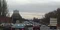
The A3 near Sortie 4

See also
 In Spanish: Autoroute A3 (Francia) para niños
