Acaponeta River facts for kids
Quick facts for kids Acaponeta River |
|
|---|---|
 |
|
|
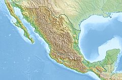
Location of mouth
|
|
| Country | Mexico |
| State | Durango, Nayarit |
| Physical characteristics | |
| River mouth | Pacific Ocean 22°22′36″N 105°38′11″W / 22.37659°N 105.63629°W |
| Length | 233 km (145 mi) |
| Basin features | |
| Basin size | 5,603.9 km2 (2,163.7 sq mi) |
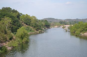
The Acaponeta River is an important river in Mexico. It starts in the state of Durango and flows all the way to the Pacific Ocean.
This river's basin, which is the area of land that drains into the river, covers about 5,399 square kilometers. That's a really big area!
River's Journey
The Acaponeta River has different names along its path. When it first starts in Durango, people call it Quebrada de San Bartolo. But once it crosses into the state of Nayarit, it becomes known as the Acaponeta River.
Where it Flows
The river travels through several municipalities and regions. In Durango, it passes through Pueblo Nuevo, Durango. Then, in Nayarit, it goes through Huajicori and Acaponeta.
It also flows by many towns and areas like Mineral de Cucharas, Quiviquinta, Huajicori, Acaponeta, San Felipe Aztatán, Tecuala, Milpas Viejas, El Filo, and Quimichis.
Reaching the Ocean
Finally, the Acaponeta River reaches the ocean at a place called Estero de Teacapán. This spot is also known as Puerta del Río, which means "River's Gate."
River Length and Use
The Acaponeta River is quite long, stretching for about 233 kilometers (or 145 miles) until it reaches Barra del Novillero.
For the last 40 kilometers (about 25 miles) of its journey, the river has a very gentle slope. This means the water flows slowly and calmly. Because of this, you can even travel by canoe on this part of the river. It's even possible to do this during the dry seasons!
See also
 In Spanish: Río Acaponeta para niños
- List of rivers of Mexico
- List of rivers of the Americas by coastline
 | James B. Knighten |
 | Azellia White |
 | Willa Brown |


