
Achilles Point facts for kids

Achilles Point is a rocky spot on a headland in Auckland, New Zealand. It sits at the end of a small sandy beach called Ladies Bay. The Māori name for this area is Te Pane o Horoiwi, which means 'The head of Horoiwi'. This name can sometimes refer to the entire headland between St Heliers and the Tamaki River. Achilles Point got its name from a ship called HMNZS Achilles (70). This ship was famous for helping to defeat a German warship in 1939. The headland was known as Te Pane o Horoiwi long before, named after Horoiwi, who arrived in New Zealand on the Tainui canoe.
Ladies Bay is a quiet beach found below steep cliffs. It's located on the headland just west of the lookout over Achilles Point.
Glover Park is a public sports field today, but it's actually an ancient volcanic crater! This volcano erupted about 160,000 years ago. It's also known as Whakahumu in Māori language. Geologists call it the 'St Heliers explosion crater'. You can find it in the middle of the headland, between West Tamaki Head and the eastern end of St Heliers Bay beach. In the 1950s, the crater was filled in to create the park we see today. Before that, it was a shallow lake or swamp that appeared during certain seasons.

The side of the crater facing the sea is slowly falling away. This creates the tall coastal cliffs above 'Gentleman's Bay' far below. The crater rim is made from ash and other material thrown out by the volcano. The cliffs were already there before the volcano erupted. The volcanic rock then covered the old clay hills. As sea levels rose, the ocean started to wear away these cliffs, making them steep. You can find some volcanic rocks on the beach below. Some are small pieces ejected from deep inside the earth, while others are larger blocks that broke off the cliff. Rangitoto Island is directly north, but it's a much younger volcano (only about 1,000 years old). It wasn't there to protect these cliffs from strong waves for most of their history. An old concrete water tower stands on the tuff ring (the crater rim) on the opposite side from the sea.
Cool Rocks and How They Form

If you walk east past Ladies Bay and Gentleman's Bay, you'll go around West Tamaki Head and into the Tamaki Estuary. Here, at Karaka Bay, you can see a great example of a grey rock called 'Parnell Grit'. This rock is a type of sedimentary rock. It's quite brittle and contains pieces of scoria, andesite, and pumice.
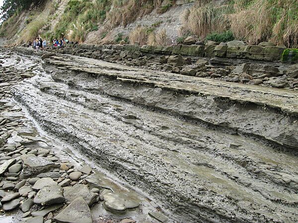
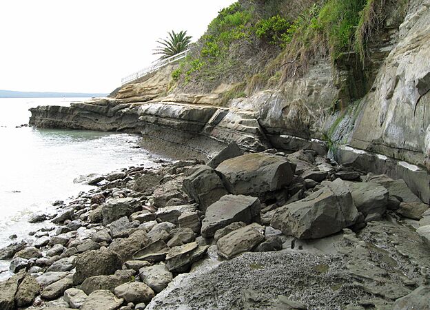
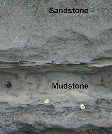
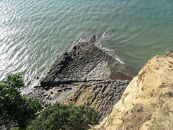
At low tide, you can take an interesting walk along the base of the cliffs from Ladies Bay to St Heliers Bay. The rocky shoreline looks out over the Waitematā Harbour. This harbour is actually a drowned valley system. It was carved out of marine sediments that are very old, from the Miocene Age (about 15–25 million years ago). Around Auckland, these soft Miocene sediments are usually layers of sandstone and mudstone from the Waitemata series. Sometimes there are also thicker layers of sandstone, and occasionally small amounts of limestone.
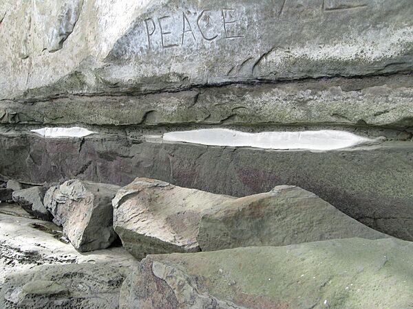
You can easily spot round, hard lumps called concretions in the cliffs. These form when groundwater, carrying dissolved minerals (mostly calcium carbonate, which is what limestone is made of), seeps through the rock layers. Calcium carbonate is a key part of concrete. It fills the tiny spaces between grains of sediment, gluing them together. This makes the rock much stronger and harder for erosion to wear away.
Gallery
- Geological features between Ladies Bay and St Heliers Bay
-
Sandstone and mudstone layers
-
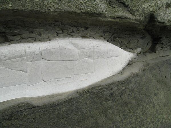
Close up of white siltstone in cliff.
-
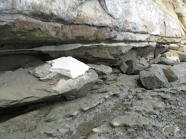
White rock broken away
-
Discoloration of crumbling white siltstone layer.
-
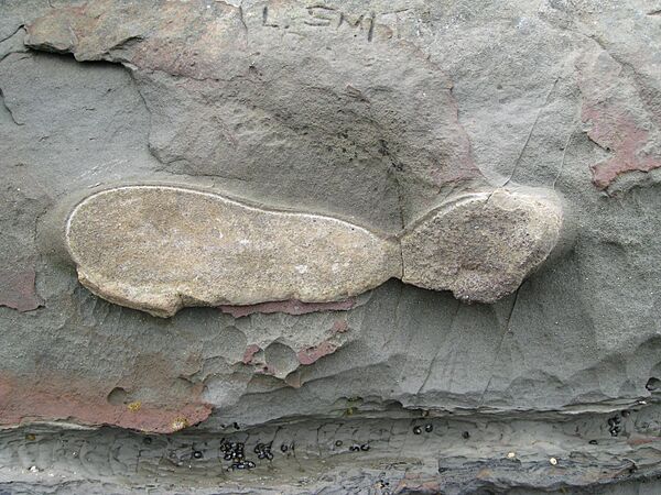
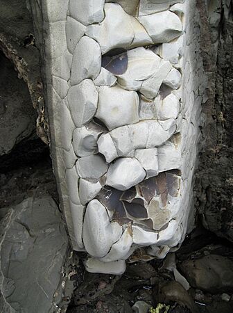
Cross-section of concretion snapped off at cliff wall.
-
Concretions all line up in the cliff wall.
-
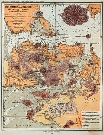
1859 map showing the volcanoes and lava flows.
-
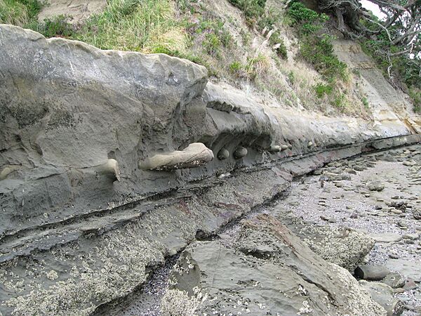
The rocks between the point and St Heliers Bay. Layers of sedimentary rock strata.
-
The rocks between the point and St Heliers Bay. White siltstone layer.
-
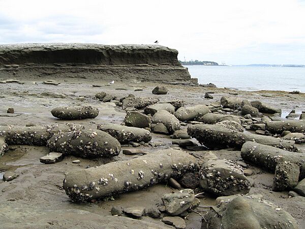
The rocks between the point and St Heliers Bay. The concretions are scattered and look like fossilised logs, long after the softer sandstone has been eroded away by the waves.
-
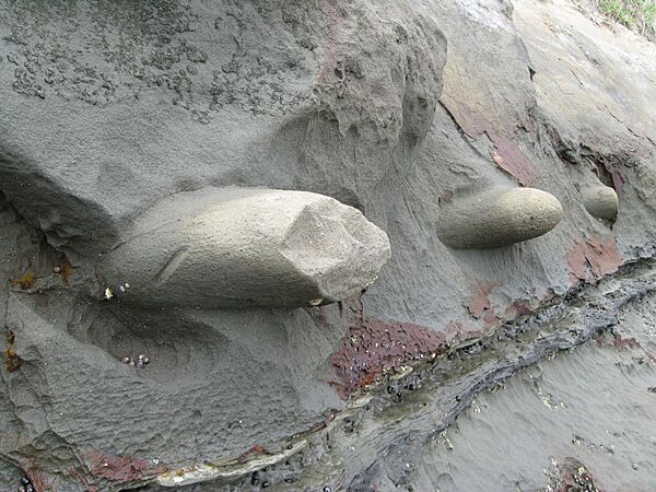
These round shapes are called concretions and are all on the same horizontal layer. Sometimes they might snap off. More often, the softer stone erodes away completely, leaving them resting on the surface a few meters lower.
-
-
Achilles Point from the viewing platform - it looks a bit like the front of a ship!
-
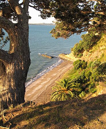
Ladies Bay
-
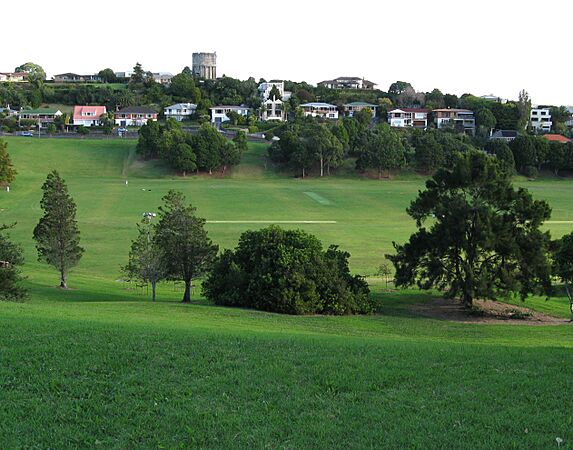
Glover Park crater


