Adaja facts for kids
Quick facts for kids Adaja |
|
|---|---|

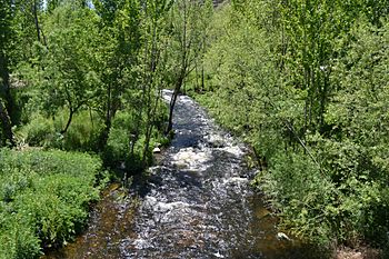
The Adaja near Ávila
|
|
| Country | Spain |
| Physical characteristics | |
| Main source | Fuente Berroqueña 40°32′22.57″N 5°09′10.09″W / 40.5396028°N 5.1528028°W |
| River mouth | Douro 41°31′59.53″N 4°51′47.81″W / 41.5332028°N 4.8632806°W |
| Length | 163 km (101 mi) |
| Basin features | |
| Progression | Douro→ Atlantic Ocean |
| Basin size | 5,328 km2 (2,057 sq mi) |
| Tributaries |
|
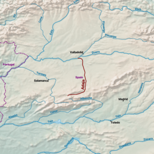
The Adaja is an important river in Spain, located right in the middle of the Iberian Peninsula. It's a big branch, or "tributary," that flows into the famous Douro River. The Adaja River is about 163 kilometers (101 miles) long, and its basin, which is the area of land that drains into the river, covers about 5,328 square kilometers (2,057 square miles).
Where the Adaja River Starts and Flows
The Adaja River begins its journey at a place called Fuente Berroqueña. This spot is near a saddle point between two mountain ranges: La Serrota and the Sierra de Ávila. It's located in the Villatoro area, within the province of Ávila.
When it first starts, the Adaja flows from the southwest towards the northeast. It travels through a wide area known as the Amblés Valley. As it reaches the city of Ávila, the river makes a turn and starts flowing mostly towards the north.
Meeting Other Rivers
As the Adaja River continues its journey, it meets other rivers that join its flow. Its most important tributary is the Eresma. The Eresma River joins the Adaja near a town called Matapozuelos.
Finally, the Adaja River empties into the larger Douro River. This meeting point is in the province of Valladolid, close to the town of Aniago.
River Facts
- The Adaja River is 163 kilometers (about 101 miles) long.
- The area of land that drains into the Adaja River is 5,328 square kilometers (about 2,057 square miles).
- It is a "left-bank tributary" of the Douro River, meaning it joins the Douro from the left side if you are looking downstream.
See also
 In Spanish: Adaja para niños
 | Dorothy Vaughan |
 | Charles Henry Turner |
 | Hildrus Poindexter |
 | Henry Cecil McBay |


