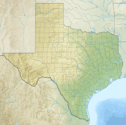
Adobes, Texas facts for kids
Quick facts for kids
Adobes, Texas
|
|
|---|---|
| Country | United States |
| State | Texas |
| County | Presidio |
| Elevation | 2,671 ft (814 m) |
| Time zone | UTC-6 (Central (CST)) |
| • Summer (DST) | UTC-5 (CDT) |
| ZIP codes |
79843
|
| Area code | 432 |
| GNIS feature ID | 2034918 |
Adobes was once a small farming community in Presidio County, Texas, United States. Today, it is known as a ghost town, meaning most people have left. It was located right by the Rio Grande river and Farm to Market Road 170.
The Story of Adobes
Adobes began as a community in the 1870s. People settled there to farm the land.
Farming Life
Farming was very important in Adobes. In 1914, farmers started growing cotton in the area. By 1930, the community had a large amount of irrigated land. This means water was brought to 750 acres (300 ha) of farmland, helping crops grow.
Adobes Today
Like many small towns, Adobes eventually became a ghost town. It reminds us of the past and how communities can change over time.
Black History Month on Kiddle
Famous African-American Architects:
 | Georgia Louise Harris Brown |
 | Julian Abele |
 | Norma Merrick Sklarek |
 | William Sidney Pittman |

All content from Kiddle encyclopedia articles (including the article images and facts) can be freely used under Attribution-ShareAlike license, unless stated otherwise. Cite this article:
Adobes, Texas Facts for Kids. Kiddle Encyclopedia.


