Aguada, Santander facts for kids
Quick facts for kids
Aguada
|
|||
|---|---|---|---|
|
Municipality and town
|
|||
|
|||

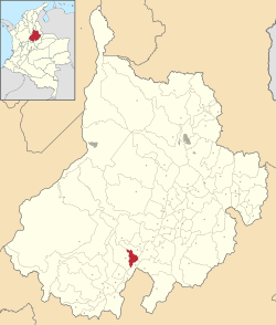
Location of the municipality and town of Aguada in the Santander Department of Colombia
|
|||
| Country | |||
| Department | Santander Department | ||
| Province | Vélez Province | ||
| Founded | 1956 | ||
| Area | |||
| • Municipality and town | 75.75 km2 (29.25 sq mi) | ||
| • Urban | 0.04 km2 (0.02 sq mi) | ||
| Elevation | 1,700 m (5,600 ft) | ||
| Population
(2015)
|
|||
| • Municipality and town | 1,855 | ||
| • Density | 24.488/km2 (63.425/sq mi) | ||
| • Urban | 225 | ||
| Time zone | UTC-5 (Colombia Standard Time) | ||
| Climate | Cfb | ||
| Website | Official website: http://www.aguada-santander.gov.co/ | ||
Aguada is a town and a type of local government area called a municipality in Colombia. It is found in the Vélez Province, which is part of the Santander Department in northeastern Colombia.
Aguada is located near the Opón River. It sits high up, about 1,700 meters (5,577 feet) above sea level. The town shares borders with other places like El Guacamayo to the north, San Benito to the south, Suaita to the east, and La Paz to the west.
History of Aguada
Long ago, before the Spanish arrived, the land where Aguada is now was home to the Yarigui people. These were native groups who lived in the area.
In early 1537, a Spanish explorer named Gonzalo Jiménez de Quesada led a difficult journey into the heart of Colombia. His group passed through the Aguada area during this trip.
The modern town of Aguada was officially founded much later, in 1956.
What is the Economy of Aguada?
The main way people in Aguada earn money is through agriculture. This means they grow many different crops.
Some of the most important crops grown here include panela reed, which is used to make a type of unrefined sugar. Farmers also grow maize (corn), beans, yuca (cassava), coffee, peas, and arracacha, which is a root vegetable.
See also
 In Spanish: Aguada (Santander) para niños
 | Roy Wilkins |
 | John Lewis |
 | Linda Carol Brown |


