Ahgykson Island facts for kids
Quick facts for kids Ahgykson Island |
|
|---|---|

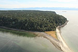
Spit off Ahgykson Island
|
|
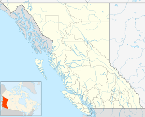
| Location | qathet RD, British Columbia |
| Coordinates | 49°52′N 124°39′W / 49.867°N 124.650°W |
| Part of | Northern Gulf Islands |
| Area | 9.25 km2 (3.57 sq mi) |
Ahgykson Island, once known as Harwood Island, is a small island located near Powell River in British Columbia, Canada. This island is a special place for the Tla'amin Nation, an Indigenous group who have lived there for thousands of years. It is part of their traditional lands and is also an Indian Reserve.
Island Names: Ahgykson and Harwood
For at least 8,000 years, the Tla'amin people have called this island "Ahgykson." This name is very important to their history and culture. However, in 1798, a European explorer named Captain Vancouver recorded it as "Harwood Island" in his maps and records.
Reclaiming the Original Name
For many years, the island was officially known as Harwood Island. But the Tla'amin people continued to use their traditional name, Ahgykson. Thankfully, the original Tla'amin name, Ahgykson, was officially brought back on April 5, 2016. This was an important step in recognizing the history and rights of the Tla'amin Nation.
Where is Ahgykson Island?
Ahgykson Island is the most northern island in a group called the Gulf Islands. These islands are found off the coast of British Columbia.
 | DeHart Hubbard |
 | Wilma Rudolph |
 | Jesse Owens |
 | Jackie Joyner-Kersee |
 | Major Taylor |


