Alb-Donau-Kreis facts for kids
Quick facts for kids
Alb-Donau
|
||
|---|---|---|
|
||
 |
||
| Country | ||
| State | Baden-Württemberg | |
| Adm. region | Tübingen | |
| Region | Donau-Iller | |
| Capital | Ulm | |
| Area | ||
| • Total | 1,357.32 km2 (524.06 sq mi) | |
| Population
(2003)
|
||
| • Total | 189,101 | |
| • Density | 139.3194/km2 (360.8356/sq mi) | |
| Time zone | UTC+1 (CET) | |
| • Summer (DST) | UTC+2 (CEST) | |
| Vehicle registration | UL | |
| Website | alb-donau-kreis.de | |
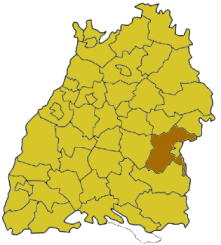
Alb-Donau is a rural area, like a county or district, located in the state of Baden-Württemberg in Germany. It's known for its beautiful landscapes and rich history.
Contents
A Look Back: History of Alb-Donau
The story of the Alb-Donau district is closely connected to the history of the city of Ulm and the Swabian Alb region.
The district you see today, Alb-Donau, was created in 1973. It was formed by bringing together two older districts: the former district of Ulm and the district of Ehingen.
Exploring the Geography of Alb-Donau
The city of Ulm is almost completely surrounded by the Alb-Donau district. Even though Ulm is not officially part of the district, it serves as its administrative center. This means the main offices for the district government are located there.
Rivers and Mountains: What's in the Name?
The district gets its name from two important natural features: the Danube River and the Swabian Alb mountains. In German, the Danube River is called Donau, and the Swabian Alb is Schwäbische Alb.
The Danube River flows into the district from the southwest. It then runs through the southern parts of the area before heading east towards Ulm.
North of the Danube, you'll find the rising hills of the Swabian Alb. This chain of hills stretches from southwest to northeast, running parallel to the Danube River. It continues beyond the district's borders on both sides.
Another important river, the Iller River, forms the southeastern border of the Alb-Donau district. The Iller River eventually joins the Danube in Ulm.
Understanding the Coat of Arms
 |
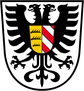
The coat of arms for the Alb-Donau district is the same as the one used by the older district of Ulm. It features a few important symbols:
|
Towns and Communities
The Alb-Donau district is made up of several towns and many smaller communities, called municipalities. Here are some of them:
| Towns | Municipalities | ||
|---|---|---|---|
|
|
|
|
See also
 In Spanish: Distrito de Alb-Danubio para niños
 | Dorothy Vaughan |
 | Charles Henry Turner |
 | Hildrus Poindexter |
 | Henry Cecil McBay |


