
Albera Massif facts for kids
Quick facts for kids Albera Massif |
|
|---|---|

The northern side of the Albera Massif seen from Sant Genís de Fontanes
|
|
| Highest point | |
| Elevation | 1,256 m (4,121 ft) |
| Geography | |

Albera Massif
Location in Pyrenees
|
|
| Location | Pyrénées-Orientales Empordà, Catalonia |
| Parent range | Foothills of the Pyrenees |
| Climbing | |
| First ascent | Unknown |
| Easiest route | From La Jonquera or Sureda |
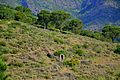
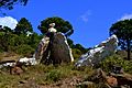
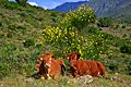
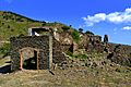
The Albera Massif (also called Serra de l'Albera in Catalan and Massif des Albères in French) is a mountain range. It sits between France and Spain, in the south of Pyrénées-Orientales and the north of Catalonia. It's like the eastern end of the big Pyrenees mountains.
The highest point in the Albera Massif is Puig Neulós, which is 1,256 metres tall. A large part of the southern side of these mountains is a special natural reserve. You can also find very old stone structures called megaliths here. The Col du Perthus pass is at the western edge of the massif.
A Border Story
The Albera Massif became an important border between France and Spain a long time ago. This happened after the Treaty of the Pyrenees was signed in 1659.
At that time, Philip IV of Spain gave some land to Louis XIV of France. This agreement split a region called Catalonia. It divided what is now Northern Catalonia from the rest of Historical Catalonia.
Gallery
-
Albera Massif
-
Albera Massif
-
Albera Massif
-
Albera Massif
_-_4.jpg)
_-_2.jpg)
_-_3.jpg)
_-_1.jpg)
See also
 In Spanish: Sierra de la Albera para niños
- Treaty of the Pyrenees
- Mountains of Catalonia
- Coll de Banyuls
