
Albert, New South Wales facts for kids
Quick facts for kids AlbertNew South Wales |
|
|---|---|

Albert Anglican Church
|
|

Albert
Location in New South Wales
|
|
| Postcode(s) | 2873 |
| Location | |
| LGA(s) | Lachlan Shire |
| State electorate(s) | Barwon |
| Federal Division(s) | Parkes |
Albert is a small town in the Central West area of New South Wales, Australia. It is part of the Lachlan Shire local government area. The town is about 481 kilometres (299 mi) west-north-west of Sydney, the state capital.
History of Albert
Copper was found in the Albert area around the year 1900. In the early 1900s, several copper mines operated nearby. The most important one was the Iron Duke Mine. It was active from about 1909 until the early 1920s.
When mining first started, the area was known as 'Albert Water Holes'. The local post office was first called 'The Alberts'. It changed its name to Albert in 1916 and closed in 1982.
A school opened in Albert in January 1899. It was first named 'Albertia' but became Albert School in January 1920. The school closed its doors in June 1972. The opening of the school and the discovery of copper suggest that Albert became a village around the time of the Federation of Australia.
Albert's Location and Transport
Albert is located on the Bogan Gate–Tottenham railway line. There used to be a train station in Albert. A short railway line also connected Albert to the nearby Iron Duke Mine. This special line was called the Albert Siding to Iron Duke Mine Railway. It stopped operating in June 1926.
Population Changes in Albert
The number of people living in Albert has changed over time. In the 2016 census, Albert had a population of 81 people. However, Albert was once much larger, with about 900 residents. By the 2021 census, the population of Albert had slightly decreased to 77 people.
Gallery
-
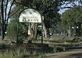
The sign that marks the entrance to the village
-
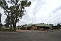
Hotel opposite Albert railway station.


