Alpine, Alaska facts for kids
Quick facts for kids
Alpine, Alaska
|
|
|---|---|
|
Former Census-designated place (CDP)
|
|

Part of the Alpine Oil Field
|
|
| Country | United States |
| State | Alaska |
| Borough | North Slope |
| Area | |
| • Total | 39.2 sq mi (101.5 km2) |
| • Land | 38.3 sq mi (99.1 km2) |
| • Water | 0.9 sq mi (2.4 km2) |
| Elevation | 13 ft (4 m) |
| Population
(2000)
|
|
| • Total | 250 (workers) |
| Time zone | UTC-9 (Alaska (AKST)) |
| • Summer (DST) | UTC-8 (AKDT) |
| Area code(s) | 907 |
| FIPS code | 02-01882 |
| GNIS feature ID | 1865544 |
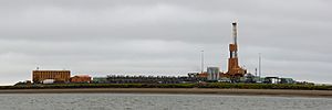
Alpine is a special area in Alaska where people work, but nobody lives there permanently. It's located in the North Slope Borough, a very cold and remote part of Alaska. This area is known for its large oil drilling operations.
The population of Alpine was listed as 0 in the 2000 United States Census. This is because it's a work camp, not a traditional community. About 250 workers are usually there. These workers often come from nearby Nuiqsut and work for two weeks, then have two weeks off.
Contents
Where is Alpine Located?
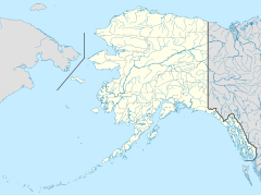
Alpine is found in the northern part of Alaska. It covers about 39.2 square miles (101.5 square kilometers). Most of this area is land, with a small part being water. It is about 8 miles north of the village of Nuiqsut, Alaska.
Getting to Alpine
The main way to get to Alpine is by air, using the Alpine Airstrip. For bigger planes or commercial flights, the closest airport is the Deadhorse Airport.
Who Lives in Alpine?
Alpine is not a place where families live. It's a work camp for people involved in the oil industry. In 2000, there were no permanent residents, but around 250 workers were present. Because no one lives there permanently, Alpine was no longer listed as a "census-designated place" after 2010.
Oil Production in Alpine
Alpine is home to a very important oil field. It was discovered in 1994 and started producing oil in November 2000. This oil field was the largest found in the United States in over ten years.
The amount of oil produced at Alpine grew steadily. In 2005, it reached its highest production level. Since then, the amount of oil produced has slowly decreased.
In 2022, there was an incident where gas was released from a well underground. Regulators in Alaska looked into the situation.
CD-5 Oil Drilling Site
In 2015, a new oil drilling site called "CD-5" began operating. This site helps reach more oil reserves. It's a big project with 33 wells, a 6-mile road, and many pipelines. It cost over $1 billion to build.
CD-5 is special because it's the first commercial oil development on Alaska Native lands within the National Petroleum Reserve-Alaska. The oil from CD-5 is processed at Alpine. Then, it travels through pipelines to the Trans-Alaska Pipeline System. This large pipeline carries oil across Alaska.
Greater Mooses Tooth Oil Projects
Two more oil projects, called Greater Mooses Tooth Unit 1 and Unit 2, were also planned near Alpine. These projects are located west of the Colville River.
- Greater Mooses Tooth Unit 1: This project started producing oil in late 2018.
- Greater Mooses Tooth Unit 2: This larger project was planned for 48 wells and also cost over $1 billion. Oil production was expected to start between late 2020 and 2021.
The roads and other structures built for the Greater Mooses Tooth units will also be used by an even bigger project called the Willow project. This shows how important Alpine's location is for oil development in Alaska.
Alpine's Weather
Alpine has a very cold climate, as it's located in the Arctic region.
| Climate data for Alpine, Alaska, 1991–2020 normals | |||||||||||||
|---|---|---|---|---|---|---|---|---|---|---|---|---|---|
| Month | Jan | Feb | Mar | Apr | May | Jun | Jul | Aug | Sep | Oct | Nov | Dec | Year |
| Mean daily maximum °F (°C) | −9.9 (−23.3) |
−9.1 (−22.8) |
−4.3 (−20.2) |
11.6 (−11.3) |
30.5 (−0.8) |
47.6 (8.7) |
56.0 (13.3) |
50.8 (10.4) |
39.8 (4.3) |
25.9 (−3.4) |
9.0 (−12.8) |
−3.0 (−19.4) |
20.4 (−6.4) |
| Daily mean °F (°C) | −15.9 (−26.6) |
−15.1 (−26.2) |
−11.9 (−24.4) |
4.6 (−15.2) |
25.5 (−3.6) |
40.9 (4.9) |
49.4 (9.7) |
44.7 (7.1) |
35.8 (2.1) |
21.6 (−5.8) |
2.1 (−16.6) |
−8.6 (−22.6) |
14.4 (−9.8) |
| Mean daily minimum °F (°C) | −22.0 (−30.0) |
−21.2 (−29.6) |
−19.5 (−28.6) |
−2.3 (−19.1) |
20.5 (−6.4) |
34.2 (1.2) |
42.8 (6.0) |
38.5 (3.6) |
31.7 (−0.2) |
17.3 (−8.2) |
−4.9 (−20.5) |
−14.3 (−25.7) |
8.4 (−13.1) |
| Average precipitation inches (mm) | 0.34 (8.6) |
0.51 (13) |
0.38 (9.7) |
0.40 (10) |
0.21 (5.3) |
0.78 (20) |
1.40 (36) |
1.37 (35) |
0.79 (20) |
0.84 (21) |
0.53 (13) |
0.57 (14) |
8.12 (205.6) |
| Source: NOAA | |||||||||||||
 | Emma Amos |
 | Edward Mitchell Bannister |
 | Larry D. Alexander |
 | Ernie Barnes |


