Amatenango de la Frontera facts for kids
Quick facts for kids
Amatenango de la Frontera
|
|
|---|---|

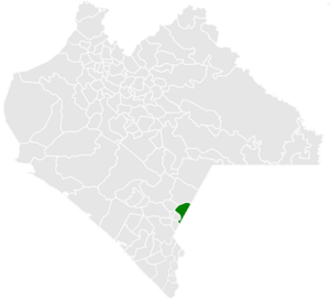
Municipality of Amatenango de la Frontera in Chiapas
|
|
| Country | |
| State | Chiapas |
| Settled | mid-17th century |
| Area | |
| • Total | 171.4 km2 (66.2 sq mi) |
| Population
(2010)
|
|
| • Total | 29,547 |
Amatenango de la Frontera is a small town and a larger area called a municipality in the southern Mexican state of Chiapas. It is located right on Mexico's border with Guatemala. This area covers about 171.4 square kilometers.
Contents
What is Amatenango de la Frontera?
Amatenango de la Frontera is both a main town and a larger administrative area. This area is known as a municipality. It is located in the state of Chiapas, which is in the southern part of Mexico. The name "de la Frontera" means "of the border." This is because it sits right on the edge of Mexico, next to the country of Guatemala.
How Many People Live There?
As of 2010, about 29,547 people lived in the municipality of Amatenango de la Frontera. This number shows that the population grew from 26,094 people in 2005. The municipality is made up of many smaller communities.
Communities and Their Sizes
The municipality has 123 different communities, which are also called localities. Some of these are bigger than others.
- El Pacayal: This is the largest community. In 2010, 3,045 people lived there. It is considered an urban area, meaning it's more like a town or city.
- Potrerillo: This community had 2,062 people in 2010.
- Nuevo Amatenango: About 1,594 people lived here in 2010.
- Guadalupe Victoria: This community had 1,541 residents in 2010.
- Nueva Morelia: In 2010, 1,032 people lived in Nueva Morelia.
The communities of Potrerillo, Nuevo Amatenango, Guadalupe Victoria, and Nueva Morelia are all considered rural areas. This means they are more like villages or countryside settlements.
See also
 In Spanish: Amatenango de la Frontera para niños
 | Bessie Coleman |
 | Spann Watson |
 | Jill E. Brown |
 | Sherman W. White |


