American Dam facts for kids
Quick facts for kids American Dam |
|
|---|---|
|
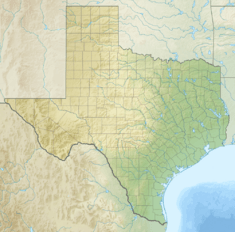
Location of American Dam in Texas
|
|
| Country | United States |
| Location | El Paso, Texas / Sunland Park, New Mexico |
| Coordinates | 31°47′03″N 106°31′40″W / 31.784234°N 106.527845°W |
| Purpose | Irrigation |
| Opening date | 1938 |
| Dam and spillways | |
| Type of dam | Diversion dam |
| Height | 5 feet (1.5 m) |
| Height (foundation) | 18 feet (5.5 m) |
| Length | 284 feet (87 m) |
| Elevation at crest | 3,684 feet (1,123 m) |
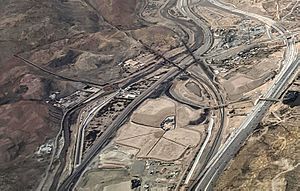
The American Dam, also known as the American Diversion Dam, is a special wall built across the Rio Grande river in El Paso, Texas. It helps control and share the river's water. This dam is located about 140 feet (43 meters) north of where the river enters Mexico. The International Boundary and Water Commission manages the dam. It began working in 1938.
Contents
Sharing the Rio Grande's Water
The idea for the American Dam came from a treaty between the United States and Mexico. This agreement, signed on May 21, 1906, was all about sharing the water from the Rio Grande fairly.
The treaty promised Mexico a certain amount of water each year. The United States would take the rest. If there was a drought, both countries would get less water, but the sharing would still be fair. Mexico would get its water from a canal called the Acequia Madre in Ciudad Juárez, which is a city just across the border.
To make sure Mexico received its agreed share, the U.S. government decided to build the American Dam in 1935. The dam measures Mexico's water portion before it reaches the international border. This water then continues down the river to the Acequia Madre. The rest of the water is sent into a new 2-mile (3.2 km) long American Canal. This canal then feeds into the Franklin Canal, which helps water farms in the 90-mile (145 km) long El Paso valley.
Where the Dam Is Located

The American Dam is an important part of the Rio Grande Project. This project manages water along the Rio Grande. The dam marks the end of the Mesilla Valley section of the river, which starts 63 miles (101 km) upstream at the Leasburg Diversion Dam. It also marks the beginning of the El Paso Valley section, which stretches 46 miles (74 km) downstream on the American side. About 52,000 acres (21,000 hectares) of farmland in the El Paso Valley are watered by this system.
About 2 miles (3.2 km) below the American Dam is the International Dam. This dam sends water to the Mexican side of the El Paso Valley, often called the Valle de Juarez. Further downstream, past the ruins at Fort Quitman, the Rio Grande riverbed can sometimes be dry until it meets the Rio Conchos river.
The dam's location, where Texas, New Mexico, and Mexico meet, means it's in an area important for border discussions. In 2019, a private group built a half-mile (0.8 km) section of border wall extending west from the dam into New Mexico. This wall included a locked gate on federal land near the dam. This gate blocked access to Monument One on the border and part of the river levee. The International Boundary and Water Commission later opened the gate to make sure they could still access the road along the riverbank by the dam.
How the Dam is Built
The American Dam was constructed between 1937 and 1938. It cost the United States Government $667,398 to build. The dam is 284 feet (86.6 meters) long and has thirteen special gates called radial gates.
Water is sent into the American Canal over a low wall, which runs parallel to the river. Two radial gates control how much water flows into the canal. The dam usually holds water about 5 feet (1.5 meters) deep. Its total structural height is 18 feet (5.5 meters). Earth walls, called dikes, are on either side of the dam. The top of the dam is 3,684 feet (1,123 meters) above sea level. The main spillway, which lets extra water flow back into the Rio Grande, can handle a lot of water, up to 12,000 cubic feet per second (340 cubic meters per second).
Canals Downstream
The American Canal is about 2 miles (3.2 km) long. It was designed to carry 1,200 cubic feet per second (34 cubic meters per second) of water. This canal runs along the north bank of the Rio Grande for its entire length. Then, it delivers water into the Rio Grande American Canal Extension (RGACE).
The RGACE carries water for the Rio Grande Reclamation Project for about 12 miles (19 km). It goes to the Riverside Canal Heading, which is just downstream from the Ysleta–Zaragoza International Bridge. By the late 1990s, the original American Canal was getting old and not working as well as it should, especially in its open sections.
The RGACE, built from 1997 to 1998, has a cement lining and replaced part of the older Franklin Canal. The Franklin Canal used to carry water through El Paso city to farms in the Lower Valley. The RGACE was designed to carry even more water, about 1,535 cubic feet per second (43.5 cubic meters per second). When the RGACE was being planned, Mexico showed interest in receiving their water share from the end of the RGACE near Riverside Dam, instead of at the Acequia Madre, which is just below the American Dam. This would involve sending the water under the Rio Grande using a special pipe called a siphon.
See Also
 | Jessica Watkins |
 | Robert Henry Lawrence Jr. |
 | Mae Jemison |
 | Sian Proctor |
 | Guion Bluford |


