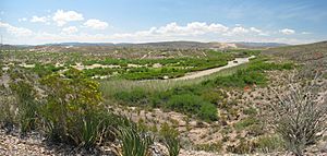
Rio Grande Project facts for kids
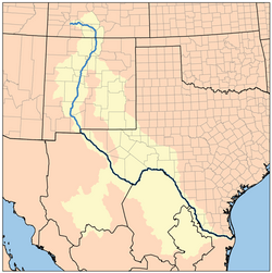
Map of the Rio Grande drainage basin
|
|
| General statistics | |
|---|---|
| Begun | 1905 |
| Completed | 1952 |
| Dams and reservoirs | Elephant Butte Caballo Percha (diversion) Leasburg (diversion) Mesilla (diversion) American (diversion) Riverside (diversion) Picacho North (flood control) Picacho South (flood control) |
| Power plants | Elephant Butte (27.95 MW) |
| Canals | 1,061 mi (1,708 km) (total) 596 mi (959 km) (irrigation) 465 mi (748 km) (drainage) |
| Operations | |
| Storage capacity | 2,453,413 acre⋅ft (3.026240 km3) |
| Land irrigated | 193,000 acres (78,000 ha) |
| Power plant capacity | 27.95 MW |
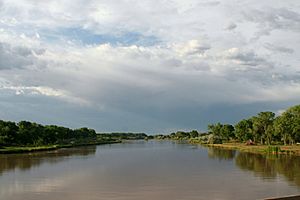
The Rio Grande Project is a huge project in the southwestern United States. It helps manage the water of the Rio Grande river. This project does many things: it helps with irrigation (watering crops), makes hydroelectricity (power from water), controls floods, and moves water between different river areas.
The project waters about 193,000 acres (780 km2) of land along the river. This land is in New Mexico and Texas. Most of this land (about 60%) is in New Mexico. Some water also goes to Mexico to water about 25,000 acres (100 km2) of land there. The project started in 1905. But it wasn't fully finished until the early 1950s.
The project includes two very large dams that store water. It also has six smaller dams that send water in different directions. There are two dams just for flood control. Plus, there are 596 miles (959 km) of canals and their smaller branches for irrigation. And there are 465 miles (748 km) of channels and pipes to drain water. A small power plant at one of the dams also makes electricity for the area.
Project History
Long before Texas became a state, the Pueblo Indians used the Rio Grande's water. They had simple ways to water their crops. Spanish explorers saw these systems in the 1500s.
In the mid-1800s, American settlers started using a lot of the Rio Grande's water. They built small walls, dams, and canals. But the river's yearly floods often washed these simple structures away. A big, planned project was needed to build stronger ones. However, studies for this big project didn't start until the early 1900s.
Like many rivers in the Southwestern United States, the Rio Grande doesn't always have a lot of water. The amount of water changes a lot each year. By the 1890s, so much water was being used upstream that the river near El Paso, Texas, almost dried up in summer.
To fix this, people planned a large dam at Elephant Butte. This spot is about 120 miles (190 km) south of Albuquerque, New Mexico. In 1902, the Newlands Reclamation Act was passed. This law allowed the Rio Grande Project to begin as a government effort. For the next two years, engineers studied the best places for dams and reservoirs.
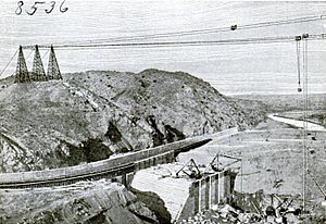
The first parts of the project were built starting in 1906. These included the Leasburg Diversion Dam and about 6 miles (9.7 km) of canal. They were finished by 1908. Elephant Butte Dam is the biggest dam on the Rio Grande. Congress approved it on February 15, 1905. Building started in 1908. There were some delays because of land issues. But work started again in 1912, and the huge lake behind the dam began to fill by 1915.
Other parts of the project were built over the next few years. The Franklin Canal was bought and rebuilt from 1914 to 1915. The Mesilla and Percha Diversion Dams, along with several canals, were built between 1914 and 1919.
In the late 1910s, a new problem came up. The ground water levels started rising because of all the irrigation. To solve this, the project began planning a huge 465-mile (748 km) drainage system in 1916. Building these drainage systems and new irrigation canals started in 1917-1918. The whole irrigation system was updated before 1929. This included fixing old canals and building new ones. Work still continues today as farming in the area grows.
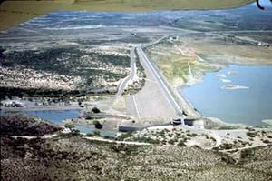
The last big parts of the project were built from the 1930s to the early 1950s. Caballo Dam is the second main storage dam. It's about 21 miles (34 km) south of Truth or Consequences, New Mexico. It was built from 1936 to 1938. Caballo Dam helps protect against floods downstream. It also makes sure water flows steadily from Elephant Butte. And it replaces storage space lost in Elephant Butte Lake due to dirt building up.
A small power plant was finished in 1940 at Elephant Butte Dam. It uses the regulated water flow to make electricity. Power lines were built starting in 1940 and finished by 1952.
The Elephant Butte Irrigation District is a special area. It is listed on the National Register of Historic Places. This means it's recognized for its history. It helps protect the old parts of the irrigation system.
Project Components
This section describes the main parts of the Rio Grande Project.
Elephant Butte Dam
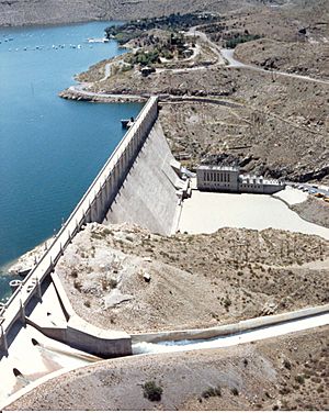
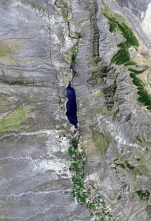
Elephant Butte Dam is the most important dam for storing water in the Rio Grande Project. It's a concrete dam, 1,674 ft (510 m) long. It stands 193 ft (59 m) above the river. The dam is 228 feet (69 m) thick at its bottom.
The lake behind the dam, Elephant Butte Reservoir, can hold about 2,109,423 acre⋅ft (2.601935×10⁹ m3) of water. This is about 85% of all the water the project can store! Water can be let out of the dam at a rate of 10,800 cu ft/s (310 m3/s). The dam also has a special overflow area (spillway) that can release 34,750 cu ft/s (984 m3/s) of water during floods.
The lake and dam collect water from a huge area of 28,900 square miles (75,000 km2). This is about 16% of the entire Rio Grande river basin. The power plant at Elephant Butte Dam makes 27.95 megawatts of electricity. This power plant runs almost all the time.
Caballo Dam
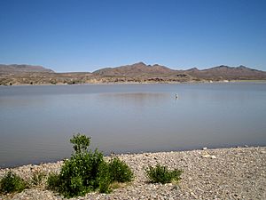
Caballo Dam is the second largest storage dam in the project. It's located about 25 miles (40 km) downstream from Elephant Butte Dam. This dam is 78 feet (24 m) tall above the river. It is 4,558 feet (1,389 m) long.
It creates Caballo Reservoir, which can hold up to 343,990 acre⋅ft (0.42431 km3) of water. Water can be released from the dam at 5,000 cubic feet (140 m3) cubic feet per second. Its spillway can handle 33,200 cubic feet (940 m3) per second. Caballo Dam does not have a power plant.
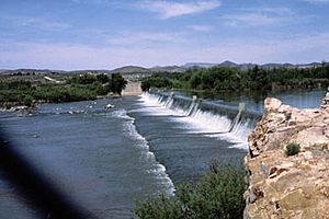
Percha Diversion Dam
Percha Diversion Dam is located downstream from Caballo Dam. It's a concrete dam with earth walls on the sides. It is 19 feet (5.8 m) tall above the river. The dam is 2,489 ft (759 m) long.
This dam sends water into the Rincon Valley Main Canal. This canal is 28.1 miles (45.2 km) long. It can carry 350 cu ft/s (9.9 m3/s) of water. Water from this canal helps water 16,260 acres (6,580 ha) of land in the Rincon Valley.
Leasburg Diversion Dam
Leasburg Diversion Dam is similar to the Percha Diversion Dam. It is 7 feet (2.1 m) tall above the river. The dam and its side walls are 3,922.3 feet (1,195.5 m) long. Its spillway is about 600 feet (180 m) long. It can handle 17,000 cu ft/s (480 m3/s) of water.
This dam sends water into the 13.7-mile (22.0 km) Leasburg Canal. This canal waters 31,600 acres (12,800 ha) of land. The canal can carry 625 cubic feet (17.7 m3) of water per second.
Pichacho North and South Dams
The Pichacho North and Pichacho South dams protect the Leasburg Canal from floods. They hold back water from two dry streambeds (arroyos). These streambeds only have water during storms. The dams were built in the 1950s.
- Pichacho North is an earth dam. It is 38 feet (12 m) tall above the streambed and 1,610 feet (490 m) long. It has a spillway that is 200 feet (61 m) long. It controls floods from an area of 11 square miles (28 km2).
- Pichacho South is 26 feet (7.9 m) tall above its streambed and 3,945 feet (1,202 m) long. Its spillway is 100 feet (30 m) long. It protects an area of 6 square miles (16 km2) from floods.
Mesilla Diversion Dam
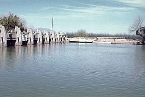
The Mesilla Diversion Dam is about 40 miles (64 km) upstream from El Paso. It has gates that can be opened and closed. The dam is 10 feet (3.0 m) tall above the Rio Grande. It is 303 feet (92 m) long. Its spillway can handle 15,000 cu ft/s (420 m3/s) of water.
This dam sends water into the East Side Canal and West Side Canal. These canals water 53,650 acres (21,710 ha) of land. The East Side Canal is 13.5 miles (21.7 km) long. The West Side Canal is larger, at 23.4 miles (37.7 km) long. Near its end, the West Side Canal goes under the Rio Grande through a special pipe called the Montoya Siphon.
American Diversion Dam
The American Diversion Dam is near El Paso, close to the border with Mexico. It has gates and earth walls. It is 5 feet (1.5 m) tall above the riverbed. Its spillway is 286 feet (87 m) long and can handle 12,000 cu ft/s (340 m3/s) of water.
This dam sends water into the American Canal. This canal carries up to 1,200 cubic feet per second (34 m3/s) of water for 2.1 miles (3.4 km). This water then goes into the Franklin Canal. The Franklin Canal is 28.4 miles (45.7 km) long. It waters 17,000 acres (69 km2) of land in the El Paso Valley.
Riverside Diversion Dam
Riverside Diversion Dam is the lowest dam in the Rio Grande Project. It is 8 feet (2.4 m) tall above the streambed and 267 feet (81 m) long. It has gates for releasing water and an emergency overflow area.
The Riverside Canal carries water 17.2 miles (27.7 km) to the El Paso Valley. It can carry about 900 cu ft/s (25 m3/s) of water. The Tornillo Canal branches off the Riverside Canal. It can carry 325 cu ft/s (9.2 m3/s). Extra water from these canals helps water about 18,000 acres (7,300 ha) in Hudspeth County, Texas.
Project Effects
Benefits of the Project
The Rio Grande Project provides water for farming all year long. It waters a long, narrow area of 178,000 acres (72,000 ha) in New Mexico and Texas. Farmers in this area grow crops like grain, pecans, alfalfa, cotton, and many kinds of vegetables.
The power plant at Elephant Butte Dam makes electricity. This power is sent through 490 miles (790 km) of power lines and 11 power stations. The government owned this power system until 1977. Then, it was sold to a local company.
Caballo and Elephant Butte lakes are also popular places for fun. Elephant Butte Lake is huge, with 36,897 acres (149.32 km2) of water when full. People love to swim, boat, and fish there. You can rent cabins, fishing gear, and boats. Caballo Lake, with 11,500 acres (47 km2) of water, is also great for picnics, fishing, and boating. Elephant Butte Lake State Park and Caballo Lake State Park are built around these two lakes.
Challenges and Impacts
Even before the Rio Grande Project, people were using too much water from the Rio Grande. By the late 1800s, there were over 900 places where water was taken from the river in Colorado alone. In 1896, experts noticed that the river's flow was dropping by 200,000 acre-feet (250,000,000 m3) each year.
The river has dried up many times since the 1950s, especially near Big Bend National Park. Near El Paso, Texas, the river often has no water for much of the year. Many smaller rivers that flow into the Rio Grande have also had their water taken for farming. The Rio Grande is now called "one of the most stressed river basins in the world." In 2001, the river didn't even reach the Gulf of Mexico. It stopped 500 feet (150 m) from the shore, blocked by sand.
The river's lower flow has also created problems for border security. In the past, the river was wide, deep, and fast where it forms part of the border with Mexico. People trying to cross the border illegally had to swim. But now, with the river so low, many can just walk across for most of the year.
Besides water being taken for irrigation, fast-growing plants like water hyacinth and hydrilla also use a lot of the river's water. These plants are not native to the area. The United States government has tried to slow down these weeds. They have released insects and fish that eat these invasive plants.
 | Jackie Robinson |
 | Jack Johnson |
 | Althea Gibson |
 | Arthur Ashe |
 | Muhammad Ali |


