Anaconda Range facts for kids
Quick facts for kids Anaconda Range |
|
|---|---|

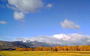
View of the Anaconda or "Pintler" Range near Anaconda, Montana
|
|
| Highest point | |
| Peak | West Goat Peak |
| Elevation | 10,793 ft (3,290 m) |
| Geography | |
| Country | United States |
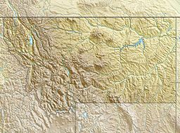
| State | Montana |
| Parent range | Rocky Mountains |
The Anaconda Range is a group of tall mountains in southwestern Montana, United States. People often call them the "Pintlers." This mountain range gets its name from the nearby town of Anaconda. The town was started by Marcus Daly in 1883.
The range stretches about 50 miles (80 km) from Lost Trail Pass towards Anaconda. It covers parts of four counties: Ravalli, Deer Lodge, Granite, and Beaverhead.
About the Anaconda Range
The Anaconda Range is surrounded by other cool places. To the northwest, you'll find the Sapphire Mountains. To the south is the Big Hole Valley. If you go north, the Anaconda Range connects with the Flint Creek Range. To the southeast, you'll see the Big Hole River and the Pioneer Mountains.
High Peaks and the Continental Divide
The very top of the Anaconda Range is part of the Continental Divide. This is a special line that separates which ocean rivers flow into. Rivers on one side flow to the Pacific Ocean, and on the other side, they flow to the Atlantic or Arctic Oceans.
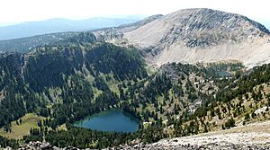
The highest point in the range is West Goat Peak. It stands tall at 10,793 feet (3290 meters). Other important peaks include:
- Mt. Evans (10,641 feet, 3243 m)
- Mt. Haggin (10,607 feet, 3233 m)
- Warren Peak (10,463 feet, 3189 m)
- East Goat Peak (10,399 feet, 3170 m)
West Pintler Peak is also a well-known spot. It reaches 9,894 feet (2895 m) high.
Protecting the Wilderness
A large part of the Anaconda Range is protected. It's called the Anaconda-Pintler Wilderness Area. This area is kept wild and natural for animals and plants. It's also a great place for people to enjoy nature.
 | Roy Wilkins |
 | John Lewis |
 | Linda Carol Brown |


