
Andaman and Nicobar Islands facts for kids
The Andaman and Nicobar Islands are a special part of India called a union territory. You might also hear them called A & N Islands or ANI for short.
These beautiful islands are located in the Indian Ocean, specifically in the southern part of the Bay of Bengal. The main town and capital of this territory is Port Blair.
The Andaman and Nicobar Islands are actually two main groups of islands: the Andaman Islands and the Nicobar Islands. They are separated by a special line on the map called the 10-degree channel. The Andaman Islands are to the north of this line, and the Nicobar Islands are to the south. This channel also separates the Andaman Sea on the east from the Indian Ocean.
Did you know these islands are home to India's only active volcano? It's called Barren Island. Some parts of these islands are not lived on by people. The islands also have the lowest point in India, which is called Indira Point.
In 2001, about 356,152 people lived on these islands. The total land area of the territory is around 6,496 km².
Cool Facts About the Islands
Island Animals and Plants
The Andaman and Nicobar Islands have their own special symbols! These symbols represent the unique nature found here.
-
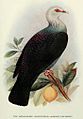
The Andaman Wood Pigeon is the official bird.
-
The Dugong, a gentle sea animal, is the official animal.
-
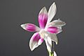
The beautiful Phalaenopsis speciosa is the official flower.
-
The Andaman Padauk is the official tree.


Images for kids
-
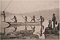
Andaman tribals fishing (around 1870)
-
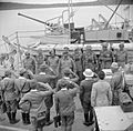
Japanese military leaders saluting Lieutenant Colonel Nathu Singh Rathore after surrendering the islands in 1945.
-
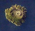
Barren Island, India's only active volcano, seen from space.
-
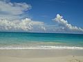
A beautiful seashore in the Andaman and Nicobar Islands.
-
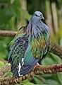
The unique Nicobar pigeon.
-
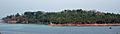
Ross Island in the Andaman group.
-
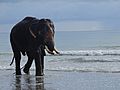
An elephant on the seashore of the Andaman and Nicobar Islands.
-
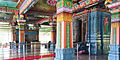
Thiru. Vettrimalai Murugan temple in Port Blair.
-
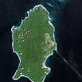
Little Andaman Island as seen by a satellite.
-

Ross Island a few days before the big tsunami in December 2004.
-
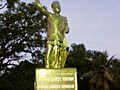
A statue of Vinayak Damodar Savarkar at Cellular Jail.
-
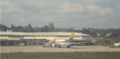
Veer Savarkar International Airport in Port Blair.
-
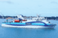
The cargo ship Sindhu, built by CSL, used for travel between the islands.
-
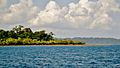
A view of the Andaman Islands.
-
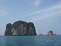
The Andaman and Nicobar islands.
-
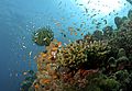
A colorful coral reef at Havelock in Andaman.
-
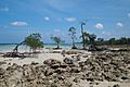
Mangrove trees growing on the beach at Shaheed Island.
-
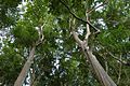
The top of a tropical rainforest canopy on Havelock Island.
-
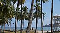
The Andaman coast with many coconut palms.
-
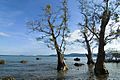
A beautiful seascape at Chidiyatapu, Andaman islands.
.jpg)


See also
 In Spanish: Islas Andamán y Nicobar para niños
