Angle Tree Stone facts for kids
Quick facts for kids |
|
|
Angle Tree Stone
|
|
 |
|
| Nearest city | Plainville, Massachusetts |
|---|---|
| Built | 1790 |
| NRHP reference No. | 76000228 |
| Added to NRHP | January 1, 1976 |
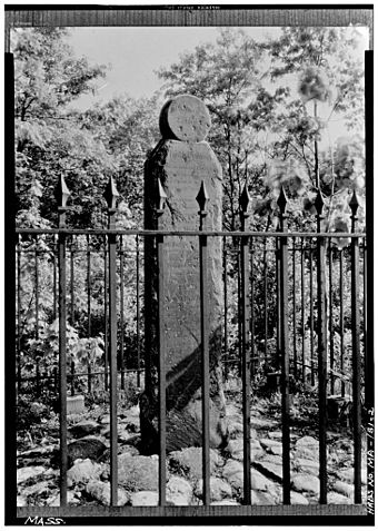
The Angle Tree Stone is an old stone marker. It sits right on the border between two towns in Massachusetts: North Attleboro and Plainville, Massachusetts. This stone is very important for history. It helps mark where different areas begin and end.
A Special Stone
This special stone was made in 1790. It was built by a father and son who made gravestones. In 1976, the Angle Tree Stone was added to the National Historic Register. This means it is a recognized historical place.
The stone replaced an old tree from the 1600s. This tree was called the "Angle Tree." It was used to mark important borders. These borders included the lines between Bristol and Norfolk counties. It also marked the line between North Attleboro and Plainville.
The county border runs straight from Cumberland, Rhode Island. It goes to where the old tree (now the stone) stands. At this spot, the line turns at an "angle." That's why it's called the Angle Tree. From there, the line runs straight almost to Massachusetts Bay.
Protecting the Stone
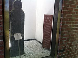
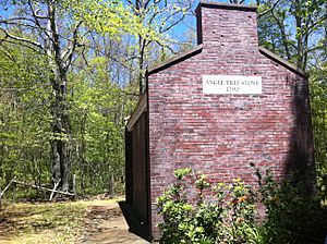
Since 1985, the Angle Tree Stone has been kept safe. It is inside a brick and clear plastic structure. This protects it from damage like graffiti. You can find the stone about a quarter-mile down a dirt road and path.
History of the Border
In 1640, two early American colonies made an agreement. The Plymouth Colony and the Massachusetts Bay Colony decided on a dividing line. This line went from Accord Pond in Hingham to Wrentham, Massachusetts. This line was very important. At that time, the land given to Massachusetts stretched all the way to the Pacific Ocean.
Over many years, people argued about this border line. It was not fully settled until much later. The U.S. Supreme Court made decisions about it in 1838 and 1846. These court cases helped to finally set the border.
What the Stone Says
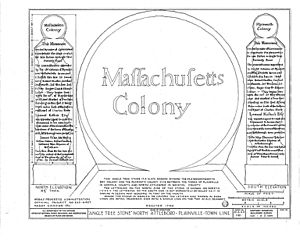
The Angle Tree Stone has words carved into it. On the north side, it says "Massachusetts Colony." On the south side, it says "Plymouth Colony."
The stone also has a longer message. It explains that the monument was put there to remember the "Angle Tree." This tree was where the border line turned.
The inscription also mentions the commissioners. These were the people who set the boundary line in 1664. They included Robert Studson, Constant Southworth, and others. They started their work on May 10, 1664. They marked a tree that was standing on that spot. This tree was three miles south of the Charles River.
The stone also notes that Lemuel Kollock, Esq., was in charge of putting up this monument. Local officials from Wrentham and Attleborough were also present. These included Samuel Fisher and John Whiting.
The inscription ends by saying that from this stone, the border line runs due west. This marks the edge of the Commonwealth of Massachusetts. The work was finished in Wrentham on November 29, 1790. It was done by Samuel Fisher and his son.
 | John T. Biggers |
 | Thomas Blackshear |
 | Mark Bradford |
 | Beverly Buchanan |


