Annapolis, Indiana facts for kids
Quick facts for kids
Annapolis, Indiana
|
|
|---|---|

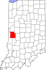
Parke County's location in Indiana
|
|
| Country | United States |
| State | Indiana |
| County | Parke |
| Township | Penn |
| Elevation | 646 ft (197 m) |
| Time zone | UTC-5 (Eastern (EST)) |
| • Summer (DST) | UTC-4 (EDT) |
| ZIP code |
47832
|
| Area code(s) | 765 |
| GNIS feature ID | 430182 |
Annapolis is a small, unincorporated community located in Parke County, within Penn Township, in the U.S. state of Indiana. An "unincorporated community" means it's a group of homes and businesses that isn't officially a city or town with its own local government.
History of Annapolis
Annapolis was first settled by people looking for a new home around 1825 or 1826. It was officially "platted" on February 4, 1837. To "plat" a town means to draw up a map showing where streets, lots, and public areas would be. This important step was done by two early settlers, William Maris, Sr., and John Moulder.
By 1910, Annapolis had grown to a population of about 200 people. It is thought that the community was named after Annapolis, Maryland, a much older and larger city. A post office, which was very important for communication back then, was opened in Annapolis in 1837. It served the community for many years before closing in 1905.
Geography of Annapolis
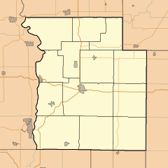
Annapolis is found in the northwestern part of Parke County. It's located about 1 mile (1.6 kilometers) north of a community called Bloomingdale. It's also less than a mile west of U.S. Route 41, which is a major road in the area. The land where Annapolis sits is about 646 feet (197 meters) above sea level.
 | Jessica Watkins |
 | Robert Henry Lawrence Jr. |
 | Mae Jemison |
 | Sian Proctor |
 | Guion Bluford |


