Arakawa River facts for kids
Quick facts for kids Arakawa River |
|
|---|---|

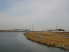
A bend in the Arakawa River
|
|
| Native name | 荒川 |
| Country | Japan |
| Physical characteristics | |
| Main source | Mount Kobushi (甲武信ヶ岳) 2,475 m (8,120 ft) |
| River mouth | Tokyo Bay |
| Length | 173 km (107 mi) |
| Basin features | |
| River system | Arakawa |
The Arakawa River (荒川, Arakawa in Japanese) is an important river in Japan. It is about 173 kilometers (107 miles) long. This river flows through two main areas: Saitama Prefecture and Tokyo.
The Arakawa River starts high up on Mount Kobushi in Saitama Prefecture. From there, it travels all the way to Tokyo Bay, where it flows into the ocean. The area that collects water for the river, called its catchment area, is about 2,940 square kilometers (1,135 square miles).
This river is very important for the people living in Tokyo. It provides a lot of their tap water. In fact, the Arakawa River, along with the Tone River, supplies about 80% of Tokyo's water.
Contents
River's Story
People have tried to control flooding from the Arakawa River for a long time. These efforts began when the area that is now Tokyo became the main capital of Japan. This happened during the Edo period, which was a long time ago.
Controlling Floods
A very big flood happened in 1910. This flood caused a lot of damage to central Tokyo. To prevent future floods, a special drainage canal was built. This canal was about 22 kilometers (14 miles) long. It took many years to build, from 1911 to 1924. This project helped protect the city from future water damage.
Sister River
In 1996, something special happened. The Arakawa River became a "sister river" to the Potomac River. The Potomac River is located in the eastern United States. This agreement helps people from both rivers share ideas and learn from each other.
Media
This river is also shown in many anime, such as Toaru Kagaku no Railgun.
 | Jewel Prestage |
 | Ella Baker |
 | Fannie Lou Hamer |

