Ardglen, New South Wales facts for kids
Quick facts for kids ArdglenNew South Wales |
|
|---|---|

Ardglen
|
|
| Postcode(s) | 2338 |
| Elevation | 703 m (2,306 ft) |
| Location | 5 km (3 mi) from Murrurundi |
| LGA(s) | Liverpool Plains Shire |
| County | Buckland |
| State electorate(s) | Upper Hunter |
| Federal Division(s) | New England |
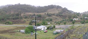
Ardglen is a small village in New South Wales, Australia. It's located in the North West Slopes region. The village is found along the Main North railway line and close to the New England Highway.
Contents
Ardglen's Past
Early Days and Name Changes
Ardglen has an interesting history, especially with its railway. A railway station first opened here on 13 August 1877. Back then, it was called Doughboy Hollow. Later, on 29 June 1893, its name was changed to Ardglen. Today, you won't find any signs of the old railway station.
The Ardglen Tunnel
A very important railway tunnel is located near the village. It's called the Ardglen Tunnel. This tunnel is 488 meters long and has only one track for trains. It passes through the Liverpool Range mountains. The Ardglen Tunnel is special because it's one of the few single-track railway tunnels still used today.
The tunnel is at the highest point of the railway line. Because of the steep slopes leading up to it, very heavy trains sometimes need extra engines. These extra engines, called "bank engines," help push the trains up the hill.
Post Office and School
Just like the railway station, the local Post Office also changed its name. The Doughboy Hollow Post Office opened in 1877. It was renamed Ardglen in 1893, but it closed down in 1983. The public school in Ardglen has also closed its doors.
Local Industry
For over 100 years, the NSW Railways has operated a hard rock quarry near Ardglen. A quarry is a place where rocks and minerals are dug out of the ground.
Where is Ardglen?
Ardglen is part of the Liverpool Plains Shire. This is a local government area (LGA) in New South Wales. It is also located in Buckland County.
Heritage-Listed Sites
Some places are very important because of their history. These are called "heritage-listed" sites. Ardglen has one such site:
- The Ardglen Tunnel on the Main Northern railway line.
 | Lonnie Johnson |
 | Granville Woods |
 | Lewis Howard Latimer |
 | James West |


