Arlington, California facts for kids
Quick facts for kids
Arlington
|
|
|---|---|
| Country | |
| State | |
| County | Riverside County |
| City | Riverside |
| Elevation | 241 m (791 ft) |
Arlington is a community in Riverside, California. It is located about seven miles southwest of downtown Riverside. Arlington is part of the Inland Empire, an area east of Los Angeles and Orange County.
About 12,300 people live in Arlington. The main shopping area is on Magnolia Avenue. This important street connects Arlington to Downtown Riverside in the east and the Corona area in the west.
The name Arlington is used for many places in the United States. Other well-known places named Arlington are in Virginia (near Washington D.C.) and Texas. The community in Southern California was named in 1877. It was likely named to honor Arlington National Cemetery. This was a way to remember soldiers who died in the Civil War.
Contents
History of Arlington
Arlington was founded in 1875. Some parts of Arlington became part of the City of Riverside when it was created in 1883. Other parts were added to Riverside later, in 1961 and 1964.
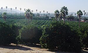
Farming was a very important part of Arlington's economy. Farmers grew a lot of citrus fruits, like oranges. This type of farming still happens today in the Arlington Heights and South Arlington neighborhoods. These areas are south of the main business district.
By 1910, a small downtown area had grown on Magnolia Avenue. A train line, the Riverside–Arlington Line, served the community. This line ran from Riverside to Corona and later became part of the larger Pacific Electric Railway system.
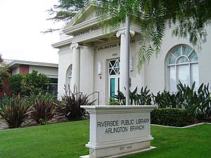
Some old buildings from this time are still standing. The Jenkins Building, built in 1910, is at Van Buren Boulevard and Magnolia Avenue. It has been home to many shops and businesses. The Arlington Branch Library, built in 1908-1909, is another old building. It was updated in 1996 and made bigger in 2008.
The first school in the area was a one-room schoolhouse on Miller Street. It was later replaced by a building from 1891, which is no longer there. This spot is now Arlington Park, a city park for the neighborhood.
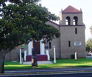
In 1901, the government started building the Sherman Institute. This school is now called the Sherman Indian High School. It is located at Jackson Street and Magnolia Avenue. The school opened in 1904 for Native American youth. Today, it helps students learn about and keep their native cultures alive.
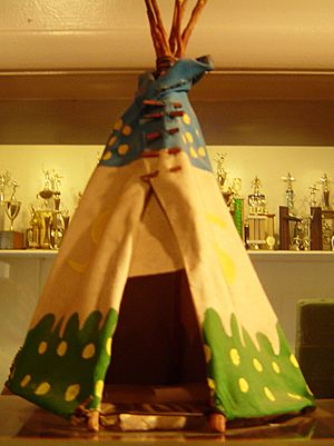
There is a small museum at 9010 Magnolia Ave. It has exhibits about the school's history and Native American traditions.
East of the school was Chemawa Park. In the early 1900s, this park had a small zoo, a roller-skating rink, and an amusement park. It also had a polo field and hosted tea parties. Since 1927, this site has been a public school.
The General Hospital of Riverside County was in Arlington from 1893 to 1998. It then moved to a new place in Moreno Valley. Parkview Community Hospital, on Jackson Street, has served the area since 1958.
After World War II, many new homes were built in Arlington. This growth continued through the 1980s. However, people living in Arlington Heights and South Arlington wanted to keep their rural citrus farms. They have worked hard to make sure farming remains a key part of their community.
Geography and Climate
Arlington is on a gently sloping plain. There are hills to the northwest (the Challen Hills) and south of the citrus farms.
It is about 30 miles (48 km) east of Anaheim and Fullerton. You can reach these cities using the 91 Freeway. Los Angeles is about two hours west by car, and San Diego is about two hours south.
Arlington is about 791 feet (241 meters) above sea level. On clear days, residents can see mountains. The San Gabriel Mountains are to the north. The San Bernardino Mountains and San Jacinto Mountains are to the east.
Weather in Arlington
The Riverside Municipal Airport weather station is the closest official station to Arlington. However, the citrus farming areas are often cooler at night. This is because they are outside the "urban heat island" effect, which makes cities warmer.
In winter, many days are warm, sometimes up to 80˚F (27˚C). But nights can be quite cold. Frost and ice happen several nights most years. This has sometimes caused problems for citrus growers.
Summers are very hot, with average high temperatures around 96˚F (36˚C). During heat waves, daytime temperatures can go above 110˚F (43˚C). Summer nights can be warm or pleasantly cool.
Arlington is on the western edge of an area that gets monsoon moisture. This brings humidity, thunderstorms, and rain during summer. Most rain falls in winter. The amount of rain changes a lot from year to year, which is normal for Southern California.
You can find accurate weather information for Arlington from the Arlington Heights weather station.
People and Economy
Arlington is part of the City of Riverside. So, information about its population is often combined with the larger 92503 zip code or the city's data.
Arlington has a large Hispanic population. This group has grown in recent years, but their roots go back to the early days of citrus farming. People in Arlington come from different economic backgrounds, from lower middle class to middle class.
The more urban parts of Arlington (north of Indiana Avenue) have more Hispanic, Asian, and African-American residents. The Arlington Heights area to the south has more Caucasian residents.
Even though Arlington is near California Baptist University, UC Riverside, and La Sierra University, many people in Arlington do not have advanced degrees. Some parts of the neighborhood have many people without a master's degree or higher.
There are also homeless people, mostly around Magnolia Avenue.
Jobs and Businesses
For many people, Arlington is a "bedroom community." This means they live in Arlington but travel to other places for work. Many commute north on Van Buren Boulevard to the Ontario area. Others travel east on Magnolia Avenue or the 91 Freeway to Downtown Riverside, San Bernardino, and other job centers in the Inland Empire.
Some residents also commute to Orange County or Los Angeles County for their jobs.
Important employers in Arlington include Parkview Community Hospital and Galleria at Tyler, a large indoor shopping mall. There are also many retail stores, restaurants, and local businesses. Public and private schools also provide jobs.
Fun Things to Do
Since 2003, the Arlington Business Partnership has hosted the Annual Chili Cook-Off & Car/Cycle Show. This event is now held on Memorial Day weekend. Magnolia Avenue is closed for the whole day for this big annual community event.
Schools in Arlington
Arlington High School serves the area. It is part of the Riverside Unified School District. There are also several private schools, such as St. Thomas the Apostle Roman Catholic School and Bethel Christian Center.
See also
 In Spanish: Arlington (California) para niños
 | Stephanie Wilson |
 | Charles Bolden |
 | Ronald McNair |
 | Frederick D. Gregory |


