Arrowsmith Island facts for kids

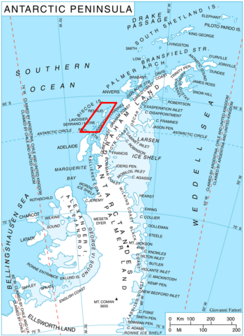
Location of Biscoe Islands in the Antarctic Peninsula region
|
|
|
Location in Antarctica
|
|
| Geography | |
|---|---|
| Location | Antarctica |
| Coordinates | 65°30′28″S 65°32′09″W / 65.50778°S 65.53583°W |
| Archipelago | Biscoe Islands |
| Administration | |
| Administered under the Antarctic Treaty System | |
| Demographics | |
| Population | Uninhabited |
Arrowsmith Island (Bulgarian: остров Ароусмит, romanized: otrov Arousmit) is a small island in Antarctica. It is mostly covered in ice. This island is part of the Pitt group, which belongs to the Biscoe Islands. Arrowsmith Island is about 2.53 kilometers (1.57 miles) long. It is also about 900 meters (0.56 miles) wide.
The island got its name from a British mapmaker named Aaron Arrowsmith (1750-1823). He created an important map of the South Pole region in 1794.
Where is Arrowsmith Island?
Arrowsmith Island is located at coordinates 65°30′28″S, 65°32′09″W. It is found near other islands in the Biscoe group. The island is about 1.43 kilometers (0.89 miles) southeast of Pickwick Island. It is also 500 meters (0.31 miles) south of Tupman Island. Another nearby island is Fizkin Island, which is 900 meters (0.56 miles) northwest. British mapmakers surveyed and mapped this area in 1971.


