Ash Grove, Indiana facts for kids
Quick facts for kids
Ash Grove, Indiana
|
|
|---|---|

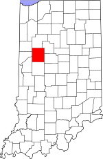
Tippecanoe County's location in Indiana
|
|
| Country | United States |
| State | Indiana |
| County | Tippecanoe |
| Township | Tippecanoe |
| Elevation | 666 ft (203 m) |
| Time zone | UTC-5 (Eastern (EST)) |
| • Summer (DST) | UTC-4 (EDT) |
| ZIP code |
47920
|
| Area code(s) | 765 |
| GNIS feature ID | 449614 |
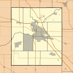
Ash Grove is a small place in Indiana that doesn't have its own city government. It's known as an unincorporated community. Ash Grove is located in Tippecanoe County, just north of a town called Battle Ground.
This community is part of the larger area around the city of Lafayette, Indiana. This bigger area is sometimes called the Lafayette Metropolitan Statistical Area.
History of Ash Grove
Ash Grove had its own post office a long time ago. It opened in 1865, which was during the American Civil War. The post office helped people send and receive mail. It closed down in 1910.
Geography and Location
Ash Grove is located in Tippecanoe Township. It sits about 666 feet (203 meters) above sea level. This means it's a bit higher than places right next to the ocean.
Black History Month on Kiddle
Influential African-American Artists:
 | James Van Der Zee |
 | Alma Thomas |
 | Ellis Wilson |
 | Margaret Taylor-Burroughs |

All content from Kiddle encyclopedia articles (including the article images and facts) can be freely used under Attribution-ShareAlike license, unless stated otherwise. Cite this article:
Ash Grove, Indiana Facts for Kids. Kiddle Encyclopedia.


