Battle Ground, Indiana facts for kids
Quick facts for kids
Battle Ground, Indiana
|
|
|---|---|
 |
|
| Motto(s):
"Historic Site of the Battle of Tippecanoe"
|
|
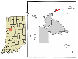
Location of Battle Ground in Tippecanoe County, Indiana.
|
|
| Country | United States |
| State | Indiana |
| County | Tippecanoe |
| Township | Tippecanoe |
| Founded | 1867 |
| Area | |
| • Town | 1.02 sq mi (2.64 km2) |
| • Land | 1.02 sq mi (2.64 km2) |
| • Water | 0.00 sq mi (0.00 km2) |
| Elevation | 650 ft (200 m) |
| Population
(2020)
|
|
| • Town | 1,838 |
| • Density | 1,801.96/sq mi (695.82/km2) |
| • Metro | 190,386 |
| Time zone | UTC−5 (Eastern (EST)) |
| • Summer (DST) | UTC−4 (EDT) |
| ZIP Code |
47920
|
| Area code(s) | 765 |
| FIPS code | 18-03718 |
| GNIS feature ID | 2396586 |
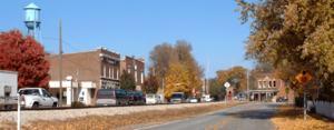
Battle Ground is a small town in Indiana, a state in the United States. It is located in Tippecanoe County. In 2020, about 1,838 people lived there. The town is famous because it is very close to the site of the historic Battle of Tippecanoe. Battle Ground is also part of the larger Lafayette metropolitan area.
Contents
History of Battle Ground
The Battle of Tippecanoe: A Key Event
In 1811, William Henry Harrison was the governor of the Indiana Territory. He led a military group against a group of Native American tribes. These tribes were forming a strong alliance. They were led by two Shawnee brothers, Tecumseh and Tenskwatawa. Tenskwatawa was also known as the Prophet.
Harrison's goal was to reach their main community, called Prophetstown. He marched from Vincennes, Indiana, with about 1,000 soldiers.
On November 6, 1811, General Harrison arrived near Prophetstown. He met with the Prophet's representatives. Harrison told them what his government wanted. They agreed to meet again the next day. Harrison set up his camp on a ridge about a mile away from Prophetstown.
Fearing a surprise attack, Harrison made his soldiers sleep in their clothes. He also had many guards watching through the night. Early on November 7, 1811, before dawn, the Prophet's forces attacked the camp.
After a tough fight, Harrison and his army won the Battle of Tippecanoe. This victory helped end the major conflicts with Native American tribes in the Midwest. Tecumseh was later killed in Canada in 1813, which further weakened the alliance.
How Battle Ground Got Its Name
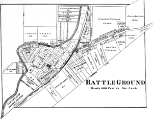
The town of Battle Ground was officially formed in 1867. It joined with another small town called Harrisonville. The leaders of both towns decided to name the new combined town "Battle Ground." This name honors the Battle of Tippecanoe. The town of Harrisonville was named after General Harrison, who led the American forces in that battle.
Tippecanoe Battlefield Monument
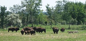
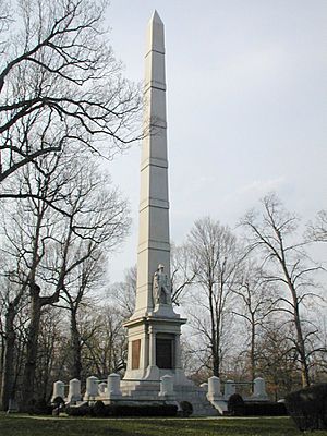
The Tippecanoe Battlefield monument was built in 1908. It honors the soldiers who fought and died in the Battle of Tippecanoe. This battlefield is now a National Historic Landmark. It has a museum and a place for recreation. A play called Battle of Tippecanoe Outdoor Drama was performed nearby in 1989 and 1990.
The town's post office has been open since 1835. The Battle Ground Historic District was added to the National Register of Historic Places in 1985. This means it is a special place with important history.
Geography and Location
Battle Ground is located in Tippecanoe Township. It is about one and a quarter miles northwest of the Wabash River. The town is about 585 feet above sea level. A small stream called Harrison Creek starts near Battle Ground and flows east. Another stream, Burnett Creek, flows along the western side of the town.
According to the 2010 census, Battle Ground covers about 0.86 square miles (2.23 square kilometers) of land. There is no water area within the town limits.
Population Information
| Historical population | |||
|---|---|---|---|
| Census | Pop. | %± | |
| 1890 | 456 | — | |
| 1900 | 150 | −67.1% | |
| 1910 | 443 | 195.3% | |
| 1920 | 444 | 0.2% | |
| 1930 | 448 | 0.9% | |
| 1940 | 506 | 12.9% | |
| 1950 | 634 | 25.3% | |
| 1960 | 804 | 26.8% | |
| 1970 | 818 | 1.7% | |
| 1980 | 812 | −0.7% | |
| 1990 | 806 | −0.7% | |
| 2000 | 1,323 | 64.1% | |
| 2010 | 1,334 | 0.8% | |
| 2020 | 1,838 | 37.8% | |
| U.S. Decennial Census | |||
What the 2010 Census Showed
In 2010, there were 1,334 people living in Battle Ground. They lived in 500 households, with 378 of these being families. The town had about 1,533 people per square mile. Most of the people living in Battle Ground were White (98.2%). A small number were from other racial backgrounds. About 2.1% of the population was Hispanic or Latino.
The average age of people in Battle Ground was 38.1 years. About 27.3% of the residents were under 18 years old.
Schools in Battle Ground
Battle Ground has its own schools for younger students. These include Battle Ground Elementary School (for grades K-3) and Battle Ground Intermediate School (for grades 4 and 5). After these schools, students go to Battle Ground Middle School for grades 6-8. For high school, students attend William Henry Harrison High School.
Famous People From Battle Ground
- General David M. Shoup (1904–1983) was a very important military leader. He served as the Commandant of the Marine Corps from 1960 to 1963.
See also
 In Spanish: Battle Ground (Indiana) para niños
 | John T. Biggers |
 | Thomas Blackshear |
 | Mark Bradford |
 | Beverly Buchanan |


