Ashland, Montana facts for kids
Quick facts for kids
Ashland, Montana
|
|
|---|---|

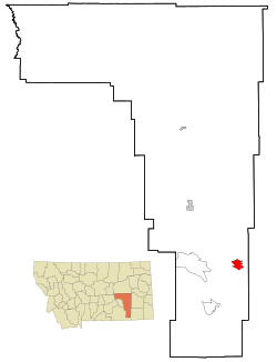
Location of Ashland, Montana
|
|
| Country | United States |
| State | Montana |
| County | Rosebud |
| Area | |
| • Total | 20.67 sq mi (53.54 km2) |
| • Land | 20.67 sq mi (53.54 km2) |
| • Water | 0.00 sq mi (0.00 km2) |
| Elevation | 2,920 ft (890 m) |
| Population
(2020)
|
|
| • Total | 773 |
| • Density | 37.40/sq mi (14.44/km2) |
| Time zone | UTC-7 (Mountain (MST)) |
| • Summer (DST) | UTC-6 (MDT) |
| ZIP codes |
59003-59004
|
| Area code(s) | 406 |
| FIPS code | 30-02800 |
| GNIS feature ID | 0802003 |
Ashland is a small community in Rosebud County, Montana, United States. It is called a census-designated place (CDP). In 2020, about 773 people lived there.
Ashland is located right next to the Northern Cheyenne Indian Reservation. It also sits along the Tongue River. The community is home to St. Labre Indian Catholic High School, which started as a boarding school in 1884.
The town of Ashland was first established in 1881. It was originally named Straders. This name came from the first person to run the post office there. The name was later changed to Ashland in 1886.
Contents
Exploring Ashland's Location and Land
Ashland is in Montana, and it covers an area of about 20.67 square miles (53.54 square kilometers). All of this area is land.
The Custer National Forest Connection
Ashland used to be the main office for the Custer National Forest. Today, it still has an Ashland Ranger District. This district is very large, covering about 436,000 acres. It has one of the biggest grazing programs for animals in the whole country.
This area is also known for having a lot of coal. Many different kinds of wildlife live here too. There has been some searching for oil and gas, but no working wells have been found yet.
Landscapes and Plants
The land around Ashland is very diverse. It ranges from gentle, rolling grasslands to steep, rocky hills. The types of plants also change a lot. You can find wide-open prairies and thick forests of ponderosa pine trees.
Ashland's Climate
Ashland has a semi-arid climate. This means it's usually dry, but not a true desert. It gets more rain than a desert, but less than a humid area.
People Living in Ashland
| Historical population | |||
|---|---|---|---|
| Census | Pop. | %± | |
| 2020 | 773 | — | |
| U.S. Decennial Census | |||
In 2000, there were 464 people living in Ashland. About 75% of the people identified as American Indian. The rest were mostly White or from two or more races.
Many households in Ashland had children under 18 living with them. The average household had about three people. The median age of people living in Ashland was 24 years old. This means half the population was younger than 24, and half was older.
Learning and Schools in Ashland
Ashland has two main schools for students.
St. Labre Indian Catholic High School
St. Labre Indian Catholic High School is a well-known school in Ashland. Its sports teams are called the Braves and Lady Braves. The school teaches students from Pre-Kindergarten all the way through 12th grade. It has been open for almost 129 years. St. Labre is especially famous for its boys' and girls' basketball teams.
Ashland Public School
Ashland also has a public school. This school teaches students from Kindergarten through 8th grade.
Local News in Ashland
The local newspaper for Ashland is called the Independent Press. It is based in Forsyth, Montana. This newspaper covers all the news for Rosebud County, which includes Ashland.
Ashland's Economy and Jobs
Ashland's economy is growing.
New Industries Coming to Ashland
There are plans for a new factory to be built in Ashland. This factory will make latex gloves. The Northern Cheyenne Tribe is supporting this project. The factory is expected to start working soon and could create up to 100 jobs for people in the area.
See also
 In Spanish: Ashland (Montana) para niños
 | Jessica Watkins |
 | Robert Henry Lawrence Jr. |
 | Mae Jemison |
 | Sian Proctor |
 | Guion Bluford |

