Ashland Creek facts for kids
Quick facts for kids Ashland Creek |
|
|---|---|

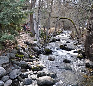
Flowing through Lithia Park
|
|
|
Location of the mouth of Ashland Creek in Oregon
|
|
| Country | United States |
| State | Oregon |
| County | Jackson |
| Physical characteristics | |
| Main source | Mount Ashland Reeder Reservoir, Siskiyou Mountains 2,947 ft (898 m) 42°09′23″N 122°43′02″W / 42.15639°N 122.71722°W |
| River mouth | Bear Creek Ashland 1,719 ft (524 m) 42°12′59″N 122°42′49″W / 42.21639°N 122.71361°W |
| Length | 5.4 mi (8.7 km) |
| Basin features | |
| Basin size | 30.6 sq mi (79 km2) |
Ashland Creek is a small river, about 5.4-mile (8.7 km) long. It flows into Bear Creek in the state of Oregon, USA. Ashland Creek joins Bear Creek near the city of Ashland. From there, Bear Creek flows another 21 miles (34 km) before joining the larger Rogue River.
The main part of Ashland Creek starts at Reeder Reservoir. This is a man-made lake that holds water for the city of Ashland. Two smaller streams, called forks, flow into this reservoir. The East Fork Ashland Creek is 5.8 miles (9.3 km) long. The West Fork Ashland Creek is 5.3 miles (8.5 km) long. Both forks start on Mount Ashland and flow north through the Rogue River – Siskiyou National Forest to reach the reservoir.
After leaving the reservoir, the main part of Ashland Creek flows north. It goes through a narrow canyon first. Then, it flows through areas where buildings are close to its banks. Finally, it reaches the wide, flat valley of Bear Creek. The river drops about 9 percent in height in its upper parts. Within the city, it drops about 3 percent.
Contents
Understanding the Ashland Creek Area
The land around Ashland Creek is called its watershed. This is the area where all the rain and snow eventually drain into the creek.
How High is the Land?
The land in the Ashland Creek watershed changes a lot in height. It goes from about 1,700 feet (520 m) where the creek meets Bear Creek. It rises all the way up to about 7,500 feet (2,300 m) in the mountains.
What Does the Land Look Like?
The entire watershed covers about 31 square miles (80 km2), which is about 20,000 acres. In 2001, most of this land was covered by forests. There were also areas with city buildings and rural homes. Some parts were used for farms. About 75 miles (121 km) of roads crossed through the watershed.
When the Creek Floods
Heavy rains and melting snow can cause problems for Ashland Creek.
Sediment and Blockages
When it rains a lot, dirt and small rocks (called sediment) wash into the creek. This sediment can build up. About 2,000 cubic yards (1,500 m3) of sediment usually collects in Reeder Reservoir each year. But in 1974, a huge flood quickly added 130,000 cubic yards (99,000 m3) of sediment. This forced the city to stop using the reservoir for water for a while.
Heavy water flows can also carry large pieces of wood and branches. These can block the creek, forming temporary dams. When these dams break, they can cause sudden, powerful surges of water.
Past Floods in Ashland
Ashland has experienced five major floods in the second half of the 20th century. The last big flood was in 1997. This flood happened when a lot of rain fell on snow. Many creeks in the Bear Creek watershed, including Ashland Creek, reached very high levels. This caused about $4.5 million in damages to properties in Ashland.
 | Sharif Bey |
 | Hale Woodruff |
 | Richmond Barthé |
 | Purvis Young |


