Atengo facts for kids
Quick facts for kids
Atengo
|
|
|---|---|
|
Municipality and town
|
|

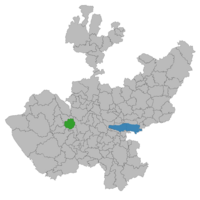
Location of the municipality in Jalisco
|
|
| Country | |
| State | Jalisco |
| Area | |
| • Total | 440.6 km2 (170.1 sq mi) |
| • Town | 2.37 km2 (0.92 sq mi) |
| Population
(2020 census)
|
|
| • Total | 5,599 |
| • Density | 12.7077/km2 (32.913/sq mi) |
| • Town | 1,639 |
| • Town density | 691.6/km2 (1,791/sq mi) |
Atengo is a small town and a municipality in the Mexican state of Jalisco. It is part of the Sierra de Amula region.
The municipality of Atengo covers an area of about 440.6 square kilometers. It is located 1,417 meters (about 4,649 feet) above sea level. In 2020, the municipality had a total population of 5,599 people.
What Does Atengo Mean?
The name "Atengo" comes from the Nahuatl language. This was the language spoken by the Aztec people. "Atengo" can be translated to "at the edge of the water." It can also mean "place situated at the border of the river" or "at the bank."
Ancient History of Atengo
Long ago, the area of Atengo was home to an ancient group of people called the Toltec. The Toltec were an important civilization in Mesoamerica. They had their own beliefs and worshiped different gods. In Atengo, they worshiped a special idol they called "Pupuca."
Towns and Villages in Atengo
The municipality of Atengo includes many small towns and villages. The main town is also called Atengo. Other places within the municipality are:
- Agostadero
- Confradia de Lepe
- Confradia de Pimienta
- Crucero
- El Macuchi
- El Ojo de Agua
- El Quemado
- El Salitre Grande
- El Salitre de Sedano
- Huaxtla
- La Chale
- Las Juntas
- Los Arribeños
- San Pedro la Chale
- San Rafael
- Soyatlán del Oro
- Tacota
- Telexeca
- Trigo de Alteñas
- La Yerbabuena
See also
 In Spanish: Municipio de Atengo para niños
 | George Robert Carruthers |
 | Patricia Bath |
 | Jan Ernst Matzeliger |
 | Alexander Miles |


