Athlone to Mullingar Cycleway facts for kids
Quick facts for kids Athlone to Mullingar Cycleway |
|
|---|---|

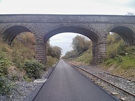
Bridge on the greenway
|
|
| Length | 42 kilometres (26 miles) |
| Location | County Westmeath, Ireland |
| Use | Cycling, Walking |
| Difficulty | Easy |
| Season | Any |
| Surface | Tarmac |
| Website | Athlone.ie |
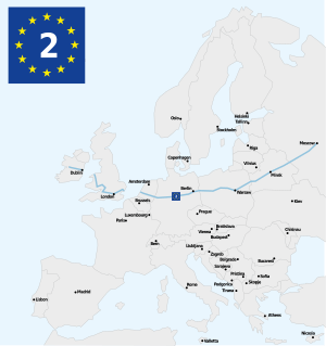
The Athlone to Mullingar Cycleway (also known as Old Rail Trail) is a fantastic long path for cycling and walking in County Westmeath, Ireland. It's a big part of the larger Dublin-Galway Greenway.
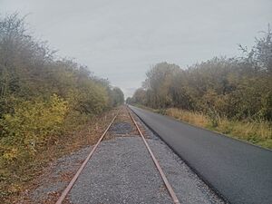
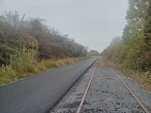
This trail is 42 kilometres (about 26 miles) long. It follows an old railway line that is no longer used. The path starts in Athlone and finishes in Mullingar. It's a great way to explore the Irish countryside!
History of the Old Rail Trail
This path used to be a busy railway line. It was first opened around 1850 by the Midland Great Western Railway company. This line was the very first one to reach Athlone from Dublin.
The railway line stopped being used for trains around 1987. After that, trains started using a different line to get to Athlone.
Building the Greenway
The first part of the greenway, from Moate to Garrycastle, was officially opened in October 2015. The person who opened it was Enda Kenny, who was the Taoiseach (the leader of the government in Ireland) at the time.
In September 2015, a local newspaper called the Westmeath Independent said that the greenway could bring a "€15 million boost" to the local area. This means it could help local businesses and create jobs.
The path was made even longer in December 2016. It reached up to Ballymahon road, also known as Whitegates. The plan is for it to eventually go right into Athlone town.
Future Plans for the Trail
There are exciting plans to connect this greenway to other cycle paths! A group in Kilbeggan, County Westmeath, is working to link the Athlone to Mullingar Greenway to the Offaly Cycleways. This would create a new greenway path to Tullamore, County Offaly. Work on this connection was planned to start around summer 2016.
Also, a brand new bridge is being built to cross the River Shannon in Athlone. This bridge received €8.1 million in funding. Construction was planned to begin in June 2021. This new bridge will make it even easier for people to enjoy the cycleway!


