Azuero Peninsula facts for kids
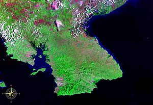
The Azuero Peninsula (which in Spanish is called Península de Azuero) is a large piece of land in southern Panama. A peninsula is land that is almost completely surrounded by water but is connected to the mainland on one side. The Azuero Peninsula has the Pacific Ocean to its south and west, and the Gulf of Panama to its east.
This peninsula is split into two main parts: the Western Azuero and the Eastern Azuero. There aren't many good roads connecting these two areas, except for the main Pan-American Highway.
The Eastern Azuero Peninsula is famous for its love of baseball. It's also a very lively place during the yearly carnaval (a big festival with parades and music). The town of Las Tablas is the center of all the carnival fun. Pedasi is a small town known for fishing, especially for sport fishing.
The Western Azuero Peninsula is known for its cattle farms, regular farms, and great fishing. It also has beautiful sunsets and lovely beaches.
More and more people are visiting the Azuero Peninsula. They come for sport fishing, surfing, and to enjoy the friendly towns like Chitré, Las Tablas, and Pedasi. Because of this, new buildings are being built. The area has some of the best weather in Panama. It's part of a region called the "Arco Seco" (which means "dry arc" in Spanish), so it doesn't get as much rain as other parts of Panama.
Geography of Azuero Peninsula
The Azuero Peninsula is divided into three different areas, called provinces. Two of these, Herrera and Los Santos, are entirely on the peninsula. The third province, Veraguas, extends onto the western side of the peninsula.
Most people live along the eastern coast. The very southern tip of the peninsula doesn't have many people living there. The western part, in the Veraguas area, is just starting to be developed.
The biggest towns are Chitré, which is the capital of Herrera, and Las Tablas. The main road to the eastern Azuero Peninsula connects to the Pan-American Highway in Divisa. From there, it goes south along the eastern side of the peninsula. Another road goes to the western Azuero, connecting to the Pan-American Highway just east of Santiago.
Punta Mariato, located on the western tip of the peninsula, is the southernmost point on the mainland of Central America.
History of Azuero Peninsula
The Azuero region was one of the first places in Panama where people settled. This happened more than 10,000 years ago! People were farming in the northern part of the peninsula thousands of years before the Spanish arrived.
Environment and Nature
Over a very long time, farming and raising animals have changed the environment here. This has led to an area in the northeast called the Sarigua desert. Even though it's not a true desert, it looks very dry.
Along the coast, you can find areas with mangroves. These are special trees that grow in salty water. Just a bit further inland, there's a dry coastal forest called Albina. The Azuero is one of the areas in Panamá where many trees have been cut down. However, new ways of farming are starting to appear, like silvopastoral grazing. This helps farmers raise animals while also growing trees.
In the far south, there's a place called Cerro Hoya National Park. This park is home to most of the remaining jungle in the Azuero region. There's also a coastal island called Isla Canas. It's connected to the peninsula by a sandbar (a ridge of sand). Many sea turtles come to Isla Canas each year to lay their eggs.
See also
 In Spanish: Península de Azuero para niños
 | John T. Biggers |
 | Thomas Blackshear |
 | Mark Bradford |
 | Beverly Buchanan |


