Bakers Crossing, Texas facts for kids
Quick facts for kids
Bakers Crossing, Texas
|
|
|---|---|
|
Unincorporated Community
|
|
| Country | United States |
| State | Texas |
| County | Val Verde |
| Elevation | 1,516 ft (462 m) |
| Time zone | UTC-6 (Central (CST)) |
| • Summer (DST) | UTC-5 (CDT) |
| ZIP codes |
78840
|
| Area code | 830 |
| GNIS feature ID | 1377969 |
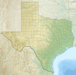
Bakers Crossing is a small, unincorporated community in Val Verde County, Texas. This means it's a settled area that doesn't have its own local government. It's located on the east side of the Devils River. The land here is about 1,516 feet (462 meters) above sea level.
Contents
History of Bakers Crossing
How Bakers Crossing Got Its Name
Bakers Crossing is named after a brave pioneer who settled in this area long ago. A pioneer is someone who is among the first to explore and settle a new region. This spot was important because it was the "second crossing" point of the Devils River. This crossing was part of the old San Antonio–El Paso Road, which was a major route for travelers and mail in the past.
Roads and Rivers
Today, Texas State Highway 163 crosses the Devils River on a modern bridge. This bridge is a little bit west of where the original crossing used to be. The original crossing was a key part of the historic San Antonio-El Paso Road.
Nearby Fort Hudson
Not far from Bakers Crossing, to the south, was a place called Camp Hudson. This camp later became known as Fort Hudson. It was located on the opposite side of the river, close to where Hudson Canyon meets the river. There were also natural springs nearby called Huffstutler Springs. These places were important for travelers and soldiers in the early days of Texas.
 | Bessie Coleman |
 | Spann Watson |
 | Jill E. Brown |
 | Sherman W. White |


