Bald Head River (Newfoundland) facts for kids
Quick facts for kids Bald Head River |
|
|---|---|
|
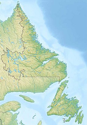
Location of the mouth of the Bald Head River in Newfoundland and Labrador
|
|
| Country | Canada |
| Province | Newfoundland and Labrador |
| Electoral district | Ferryland |
| Physical characteristics | |
| Main source | Unnamed lake 96 m (315 ft) 47°20′16″N 52°44′49″W / 47.33778°N 52.74694°W |
| River mouth | Atlantic Ocean 0 m (0 ft) 47°19′23″N 52°44′32″W / 47.32306°N 52.74222°W |
| Length | 2 km (1.2 mi) |
The Bald Head River is a short river located in Newfoundland and Labrador, Canada. It flows on the Avalon Peninsula, which is a large piece of land in the eastern part of Newfoundland. This river is named after a nearby piece of land that sticks out into the ocean, called Bald Head.
Contents
What is the Bald Head River?
The Bald Head River is a small but interesting river. It is known for being quite short, only about 2 kilometers (or 1.2 miles) long. Rivers like this are important parts of the local environment.
Where is the Bald Head River Located?
This river is found in the Ferryland electoral district. This area is on the Avalon Peninsula in Newfoundland and Labrador. The river flows into the Atlantic Ocean.
It ends its journey near a landform called Bald Head. This "headland" is a piece of land that extends out into the sea. The river's mouth is also about 5.5 kilometers (or 3.4 miles) northeast of a community called Bay Bulls.
How Long is the River's Journey?
The Bald Head River starts its flow from an unnamed lake. This lake is located about 96 meters (or 315 feet) above sea level. From there, the river travels a short distance.
Journey of the River
After leaving the unnamed lake, the river flows through a small body of water called Bald Head Pond. Finally, it reaches its end at the vast Atlantic Ocean. At this point, the river is at sea level, meaning its elevation is 0 meters.
 | Aaron Henry |
 | T. R. M. Howard |
 | Jesse Jackson |


