Baldridge, Indiana facts for kids
Quick facts for kids
Baldridge, Indiana
|
|
|---|---|

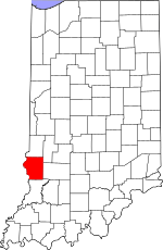
Sullivan County's location in Indiana
|
|
| Country | United States |
| State | Indiana |
| County | Sullivan |
| Township | Curry |
| Elevation | 591 ft (180 m) |
| Time zone | UTC-5 (Eastern (EST)) |
| • Summer (DST) | UTC-4 (EDT) |
| ZIP code |
47850
|
| Area codes | 812, 930 |
| GNIS feature ID | 430450 |
Baldridge is a small, unincorporated community located in Curry Township, within Sullivan County, in the state of Indiana, United States. An unincorporated community is a place where people live together, but it doesn't have its own official local government like a city or town. Instead, it's usually managed by the county.
This community is also part of the larger Terre Haute area. This means it's connected to the bigger city of Terre Haute for things like jobs and services.
A Bit of History
Baldridge likely got its name from a nearby coal mine. Many communities in this region were named after important local industries or features.
Where is Baldridge?
Baldridge is located at specific geographic coordinates: 39 degrees, 13 minutes, 22 seconds North latitude, and 87 degrees, 22 minutes, 13 seconds West longitude. These numbers help pinpoint its exact spot on a map of the world. It sits about 180 meters (or 591 feet) above sea level.
 | Aurelia Browder |
 | Nannie Helen Burroughs |
 | Michelle Alexander |


