Bara Tehsil facts for kids
Quick facts for kids
Bara
تحصیل باڑہ
باړه تحصیل |
|
|---|---|
|
Tehsil
|
|

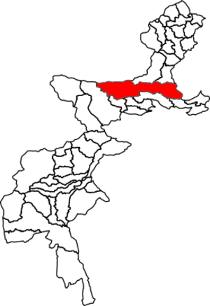
Location of Bara Tehsil in the Federally Administered Tribal Areas
|
|
| Country | |
| Region | |
| District | Khyber District |
| Headquarters | Bara |
| Population
(2017)
|
|
| • Total | 444,403 |
| Time zone | UTC+5 (PST) |
Bara Tehsil (Urdu: باڑہ) is a special area, or "subdivision," located in the Khyber District of Khyber Pakhtunkhwa, a province in Pakistan. It's a place where many people live and learn.
Contents
Where is Bara Tehsil?
Bara Tehsil is located in the Khyber Pakhtunkhwa province of Pakistan. It shares borders with several other areas. To the north and northwest, it touches parts of Afghanistan. It also borders other tehsils and districts within Pakistan, like Landi Kotal Tehsil and Peshawar District.
Who Lives in Bara Tehsil?
Bara Tehsil is home to many people. According to a count taken in 2017, about 444,403 people live there. These people live in about 51,869 households.
| Historical population | ||
|---|---|---|
| Year | Pop. | ±% |
| 1972 | 242,315 | — |
| 1981 | 142,501 | −41.2% |
| 1998 | 286,184 | +100.8% |
| 2017 | 444,403 | +55.3% |
Learning in Bara Tehsil
Education is very important in Bara Tehsil. There are around 400 schools and colleges in the area. Sadly, over a ten-year period, 102 schools were damaged. This meant that about 64,000 students could not go to school anymore. Efforts are being made to help students get back to their studies.
Getting Around Bara Tehsil
Bara Tehsil is connected to the city of Peshawar by a road called the Peshawar-Bara road. This road is very important for travel and trade. For some time, from 2009 to 2013, the road was closed. It was reopened to help people travel more easily.
 | Isaac Myers |
 | D. Hamilton Jackson |
 | A. Philip Randolph |

