Barbate (river) facts for kids
Quick facts for kids Barbate |
|
|---|---|
 |
|
| Country | Spain |
| Physical characteristics | |
| Main source | Sierra del Aljibe 920 metres (3,020 ft) |
| River mouth | Atlantic Ocean (Barbate) 0 m (0 ft) |
| Length | 80 kilometres (50 mi) |
| Basin features | |
| Basin size | 1,290 square kilometres (500 sq mi) |
| Tributaries |
|
The Barbate River (also called Spanish: Río Barbate) is a river located in southern Spain. It flows into the Atlantic Ocean near the town of Barbate. This town, found in the province of Cádiz in the Andalusia region, is actually named after the river!
Contents
Where the Barbate River Begins
The Barbate River starts high up in the mountains. Its source is in the northern part of the Sierra del Aljibe mountain range. Here, the river begins at about 920 metres (3,020 ft) above sea level.
The River's Journey Downhill
At first, the river drops very quickly. It falls about 600 metres (2,000 ft) in just 10 kilometres (6.2 mi)! This part of the river flows over very old rocks from the Triassic period. After this steep start, the river slows down. It flows more gently, losing only 200 metres (660 ft) in height for the rest of its journey.
Flowing Through Different Lands
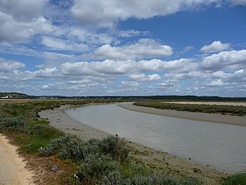
As the Barbate River continues, it meets another river called the Alberite. After this meeting, the Barbate flows through flatter land. Because the land is so flat, the river winds and turns a lot. This creates many bends, which are called meanders. The Barbate River is over 80 kilometres (50 mi) long in total.
The River's Basin and Tributaries
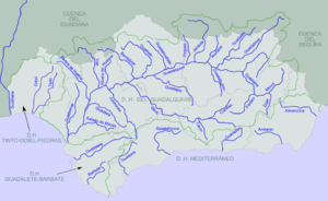
The Barbate River and its smaller rivers (called tributaries) collect water from a large area. This area is known as its basin. The Barbate River basin covers about 1,290 square kilometres (500 sq mi). This is a big part of the Cádiz province, about 17.6 percent of it!
Rich Soils and Other Rivers
The river flows through wide, fertile plains. These areas have amazing dark clay soils. Locals call these soils bujeo or tierras negras andaluzas, which means "black Andalusian lands." These soils are great for farming.
The Barbate River eventually reaches an area that used to be a large lagoon called the Janda Lagoon. Now, this area is dry. Here, another important river, the Almodóvar, joins the Barbate from the left side. Other rivers that flow into the Barbate include the Rocinejo, the Celemín (river), the Álamo, and the Fraja.
Journey to the Sea
As the Barbate River gets closer to the ocean, it passes by several towns. These include Alcalá de los Gazules and Benalup-Casas Viejas.
Through the Marshes
After flowing through a narrow passage called the Barca de Vejer gorge, the river enters the Marismas de Barbate. These are large marshlands, about 9 kilometres (5.6 mi) long. Finally, the Barbate River reaches its mouth at the town of Barbate and flows into the Atlantic Ocean.
See also
 In Spanish: Río Barbate para niños
 | Selma Burke |
 | Pauline Powell Burns |
 | Frederick J. Brown |
 | Robert Blackburn |


