
West Springfield, Virginia facts for kids
Quick facts for kids
West Springfield, Virginia
|
|
|---|---|
|
Houses in West Springfield
|
|

Location of West Springfield in Fairfax County, Virginia
|
|

West Springfield, Virginia
Location in Northern Virginia

West Springfield, Virginia
Location in Virginia

West Springfield, Virginia
Location in the United States
|
|
| Country | United States |
| State | Virginia |
| County | Fairfax |
| Area | |
| • Total | 4.83 sq mi (12.50 km2) |
| • Land | 4.80 sq mi (12.42 km2) |
| • Water | 0.03 sq mi (0.08 km2) |
| Elevation | 272 ft (83 m) |
| Population
(2020)
|
|
| • Total | 23,396 |
| • Density | 4,847/sq mi (1,871.6/km2) |
| Time zone | UTC−5 (Eastern (EST)) |
| • Summer (DST) | UTC−4 (EDT) |
| ZIP code |
22152
|
| Area code(s) | 703, 571 |
| FIPS code | 51-84976 |
| GNIS feature ID | 1493775 |
West Springfield is a community in Fairfax County, Virginia, United States. It is known as a census-designated place (CDP). This means it is a special area set up by the government for counting people. In 2020, about 23,369 people lived there.
Contents
Where is West Springfield Located?
West Springfield is in the middle of Fairfax County. It is located at coordinates 38.788436 degrees North and -77.232802 degrees West.
Natural Borders and Area
The area has natural and man-made borders. To the north, you'll find the Norfolk Southern Railway. Accotink Creek is to the east. Fort Belvoir and the Fairfax County Parkway are to the south. Pohick Creek and a power line mark the western edge.
West Springfield covers about 12.45 square kilometers (4.81 square miles). A very small part of this area, about 0.08 square kilometers (0.03 square miles), is water.
How Many People Live Here?
| Historical population | |||
|---|---|---|---|
| Census | Pop. | %± | |
| 1970 | 14,143 | — | |
| 1980 | 25,012 | 76.9% | |
| 1990 | 28,126 | 12.5% | |
| 2000 | 28,378 | 0.9% | |
| 2010 | 22,460 | −20.9% | |
| 2020 | 23,369 | 4.0% | |
| source: | |||
In 2010, there were 22,460 people living in West Springfield. They lived in 10,289 homes. About 7,840 of these were families.
Who Lives in West Springfield?
Most people in West Springfield are White (about 75%). There are also many Asian people (about 14%) and African Americans (about 5%). People from other backgrounds also make up the community. About 7% of the people are Hispanic or Latino.
Many homes (about 37%) had children under 18 living there. Most homes (about 64%) were married couples. The average home had about 2.76 people.
Age and Income
The average age of people in West Springfield was 39 years old. About 25% of the people were under 18. About 10% were 65 or older.
In 2007, the average income for a household was about $97,203. For families, it was about $106,667. Only a small number of families (about 1.7%) lived below the poverty line.
Schools in West Springfield
Fairfax County Public Schools runs the public schools in the area.
Elementary Schools
- Cardinal Forest Elementary School
- Keene Mill Elementary School
- Rolling Valley Elementary School
- West Springfield Elementary School
Middle and High Schools
- Irving Middle School
- West Springfield High School
Other Schools
St. Bernadette Catholic School is also in West Springfield. It is part of the Roman Catholic Diocese of Arlington.
Images for kids
-
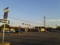
Intersection of Old Keene Mill Rd. and Rolling Rd. in West Springfield

See also
 In Spanish: West Springfield (Virginia) para niños
