Fairfax County, Virginia facts for kids
Quick facts for kids
Fairfax County
|
|||||
|---|---|---|---|---|---|
|
Mount Vernon plantation
Fairfax County Government Center
|
|||||
|
|||||
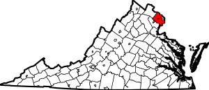
Location within the U.S. state of Virginia
|
|||||
 Virginia's location within the U.S. |
|||||
| Country | |||||
| State | |||||
| Founded | June 19, 1742 | ||||
| Named for | Thomas Fairfax, 6th Lord Fairfax of Cameron | ||||
| Seat | Fairfax (independent city)1 | ||||
| Largest town | Herndon | ||||
| Area | |||||
| • Total | 406 sq mi (1,050 km2) | ||||
| • Land | 391.02 sq mi (1,012.7 km2) | ||||
| • Water | 15.47 sq mi (40.1 km2) 3.8% | ||||
| Population
(2020)
|
|||||
| • Total | 1,150,309 | ||||
| • Density | 2,941.82/sq mi (1,135.84/km2) | ||||
| Time zone | UTC−5 (Eastern) | ||||
| • Summer (DST) | UTC−4 (EDT) | ||||
| ZIP Codes |
20120, 20121, 20122, 20124, 20151, 20152, 20153, 20164, 20166, 20170, 20171, 20172, 20190, 20191, 20192, 20194, 20195, 20196, 22003, 22009, 22015, 22018, 22019, 22027, 22030, 22031, 22032, 22033, 22035, 22037, 22038, 22039, 22041, 22042, 22043, 22044, 22046, 22060, 22066, 22067, 22079, 22081, 22082, 22101, 22102, 22106, 22116, 22121, 22124, 22150, 22151, 22152, 22153, 22158, 22159, 22160, 22161, 22180, 22181, 22182, 22183, 22185, 22199, 22203, 22204, 22205, 22206, 22207, 22213, 22302, 22303, 22304, 22306, 22307, 22308, 22309, 22310, 22311, 22312, 22315
|
||||
| Area code | 703, 571 | ||||
| Congressional districts | 8th, 10th, 11th | ||||
| 1 Administrative and court offices are located in unincorporated areas in Fairfax County | |||||
Fairfax County, also known as the County of Fairfax, is a large county in Virginia. It's the most populated county in Virginia. In 2020, over 1.1 million people lived here! It's also the busiest area in the Washington metropolitan area. The main town for the county is Fairfax. But Fairfax City is actually a separate city, not part of the county itself.
Fairfax County is in Northern Virginia. It's a suburban area, meaning it has many neighborhoods and towns around a big city. It's very close to Washington, D.C., the nation's capital. The county borders Montgomery County, Maryland to the north. It also borders Falls Church, Alexandria, Arlington County, and Prince George's County, Maryland to the east. To the southeast is Charles County, Maryland. To the southwest is Prince William County. And to the northwest is Loudoun County.
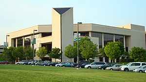
Many important government offices are in Fairfax County. This includes parts of the CIA headquarters in Langley. Several large companies also have their main offices here. Fairfax County is known for being one of the wealthiest counties in the United States.
Contents
History of Fairfax County

Before Europeans arrived, the Doeg tribe lived in the area that is now Fairfax County. They spoke the Algonquian language.
Early History
In 1608, explorer Captain John Smith wrote about the Doeg tribe's villages. These villages were along the south side of the Potomac River. By 1670, settlers from Virginia moved the Doeg Tribe out of this area. The tribe then moved into Maryland.
1700s and 1800s
Fairfax County was created in 1742. It was formed from the northern part of Prince William County. The county was named after Thomas Fairfax, 6th Lord Fairfax of Cameron. He owned a lot of land in the area. His family name, Fairfax, means "blond hair" in Old English.
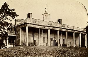
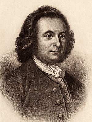
Some of the first settlements were along the Potomac River. George Washington, who became the first U.S. President, lived here. He built his famous home, Mount Vernon, facing the Potomac. Another important historical home, Gunston Hall, belonged to George Mason. Fort Belvoir is also partly on land that was once a large estate called Belvoir Manor.
In 1757, a big part of Fairfax County became Loudoun County. Later, in 1789, some of Fairfax County was given to the U.S. government. This land helped form Alexandria County, which was part of Washington, D.C..
During the American Civil War, some battles happened in Fairfax County. The Battle of Chantilly was fought here. Other important Civil War sites in the county included Minor's Hill and Munson's Hill.
Modern Times
After World War II, the U.S. government grew a lot. This caused Fairfax County to grow very quickly. It changed from a rural area with farms to a busy suburban region. Many large businesses started to move into the county.
The opening of Tysons Corner Center helped Tysons become a major business area. The growth of technology companies and steady government jobs led to more people moving here. This made Fairfax County one of the richest counties in the country.
Where is Fairfax County?
Fairfax County covers about 406 square miles. Most of this is land, with about 15 square miles of water. The county has many trees, covering over half of its land.
The Potomac River forms the northern and southeastern borders of the county. Across the river to the northeast is Washington, D.C.. To the north across the river is Montgomery County, Maryland. To the southeast across the river are Prince George's County, Maryland and Charles County, Maryland.
Fairfax County is also bordered by Arlington County and the cities of Alexandria and Falls Church. To the west is Loudoun County. To the south is Prince William County.
Most of the county has rolling hills and deep stream valleys. This area is part of the Piedmont region. The western part of the county is flatter.
People of Fairfax County
How Many People Live Here?
| Historical population | |||
|---|---|---|---|
| Census | Pop. | %± | |
| 1790 | 12,320 | — | |
| 1800 | 13,317 | 8.1% | |
| 1810 | 13,111 | −1.5% | |
| 1820 | 11,404 | −13.0% | |
| 1830 | 9,204 | −19.3% | |
| 1840 | 9,370 | 1.8% | |
| 1850 | 10,682 | 14.0% | |
| 1860 | 11,834 | 10.8% | |
| 1870 | 12,952 | 9.4% | |
| 1880 | 16,025 | 23.7% | |
| 1890 | 16,655 | 3.9% | |
| 1900 | 18,580 | 11.6% | |
| 1910 | 20,536 | 10.5% | |
| 1920 | 21,943 | 6.9% | |
| 1930 | 25,264 | 15.1% | |
| 1940 | 40,929 | 62.0% | |
| 1950 | 98,557 | 140.8% | |
| 1960 | 275,002 | 179.0% | |
| 1970 | 455,021 | 65.5% | |
| 1980 | 596,901 | 31.2% | |
| 1990 | 818,584 | 37.1% | |
| 2000 | 969,749 | 18.5% | |
| 2010 | 1,081,726 | 11.5% | |
| 2020 | 1,150,309 | 6.3% | |
| U.S. Decennial Census 1790–1960 1900–1990 1990–2000 2010 2020 |
|||
In 2020, Fairfax County had 1,150,309 people. It's the most populated county in Virginia. The average age of people living here was about 39.4 years old. About 22.6% of the people were under 18.
Many people in Fairfax County speak a language other than English at home. About 30.7% of residents were born outside the United States. Most of these people have become U.S. citizens.
Fairfax County is known for its high income. The average household income in 2020 was $145,164. This makes it one of the wealthiest counties in the country.
Learning and Schools
Schools and Colleges
Fairfax County has a large public school system called Fairfax County Public Schools. The county government gives a big part of its budget to these schools. In 2023, the school system's budget was $3.5 billion. This means about $18,772 is spent on each student.
One very special school in the county is Thomas Jefferson High School for Science and Technology. It's a top-ranked high school in the U.S. Students from many counties come here to study science and engineering.
For college, George Mason University is located just outside Fairfax City. Northern Virginia Community College (NVCC) also has campuses in the county. These include locations in Annandale and Springfield.
Jobs and Economy
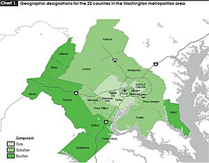
Fairfax County's economy is mostly about professional services and technology. Many people work for the government or for companies that work with the government. Fort Belvoir is a large military base and a big source of federal jobs. The county's economy is worth about $95 billion.
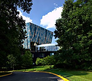
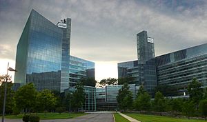
Many big companies have their main offices in Fairfax County. Some of these include Hilton Worldwide and Northrop Grumman. Other major employers are Capital One and Freddie Mac. The county is home to several companies listed in the Fortune 500.
The Fairfax County Economic Development Authority helps businesses grow here. Fairfax County has more high-tech workers than even Silicon Valley.
Tysons: A Business Hub
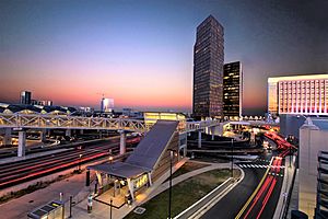
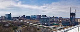
Tysons is a very important business area in Fairfax County. It has the most office space in Virginia. It's one of the biggest suburban business districts in the U.S. Tysons is expected to grow even more in the future.
Many people come to Tysons for work and shopping. It has two very large shopping malls: Tysons Corner Center and Tysons Galleria.
The Washington Metro Silver Line subway system has four stations in Tysons. This helps people get around easily. The county also plans to make Tysons more like a city. This includes adding more homes so people can live closer to their jobs.
Top Employers
Here are some of the largest employers in Fairfax County:
| # | Employer | # of Employees |
|---|---|---|
| 1 | Federal government of the United States | 27,821 |
| 2 | Fairfax County Public Schools | 25,526 |
| 3 | Inova Health System | 20,000 |
| 4 | Fairfax County Government | 12,426 |
| 5 | George Mason University | 5,000-9,999 |
| 6 | Booz Allen Hamilton | 5,000-9,999 |
| 7 | Amazon | 5,000-9,999 |
| 8 | Capital One | 5,000-9,999 |
| 9 | SAIC | 5,000-9,999 |
| 10 | Federal Home Loan Mortgage Corporation | 5,000-9,999 |
Fun Things to Do
Fairfax County has many fun events and places to visit. The "Celebrate Fairfax!" festival happens every June. The Tephra Fine Arts Festival is held in May in Reston. The International Children's Festival at Wolf Trap is in September. It takes place at the Wolf Trap National Park for the Performing Arts.
The county also has free summer concerts. These are held in different parks and venues.
Capital One Hall in Tysons is a big performing arts center. It opened in 2021. EagleBank Arena at George Mason University hosts concerts and shows. The Workhouse Arts Center in Lorton, Virginia has art studios and galleries.
Getting Around
Major Roads
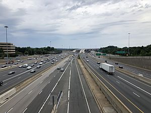
Many major highways go through Fairfax County. These include Interstate 495 (the Capital Beltway), Interstate 66, and Interstate 95. The American Legion Bridge connects Fairfax to Maryland. Other important roads are the George Washington Memorial Parkway and the Dulles Toll Road.
Airports
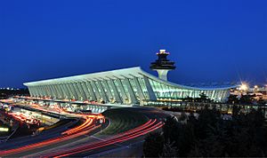
Dulles International Airport is partly in Fairfax County. It provides most of the air travel for the area. Other nearby airports are Ronald Reagan Washington National Airport and Baltimore-Washington International Thurgood Marshall Airport.
Public Transport

Fairfax County has several public transportation options. The Washington Metro subway system has Blue, Orange, Silver, and Yellow lines here. The Silver Line opened in 2014 and was extended in 2022. It runs through Tysons, Reston, and Herndon.
The Virginia Railway Express (VRE) offers commuter train service. It connects Fairfax County to Union Station in Washington, D.C. The county also has its own bus service called the Fairfax Connector.
Parks and Nature
Fairfax County has over 390 county parks. These parks cover more than 23,000 acres. The Fairfax County Park Authority manages these parks and recreation centers.
There are also national parks and protected areas here. These include Elizabeth Hartwell Mason Neck National Wildlife Refuge and Wolf Trap National Park for the Performing Arts. Mason Neck State Park is also in Lorton.
The county has many miles of bike trails. These trails go through parks and towns. The Washington & Old Dominion Railroad Trail is great for walking and biking. The Mount Vernon Trail also runs along the Potomac River. The Gerry Connolly Cross County Trail goes from Great Falls National Park to Occoquan Regional Park. It's popular for mountain biking, hiking, and horse riding.
Communities in Fairfax County
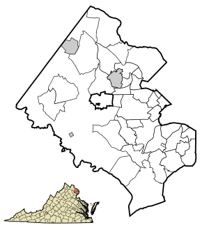
Fairfax County has three official towns: Clifton, Herndon, and Vienna.
The cities of Falls Church and Fairfax used to be part of the county. But now they are separate cities. Even so, some parts of Fairfax County have mailing addresses that say Falls Church or Fairfax City. Some areas also use Alexandria mailing addresses.
Most of the communities in Fairfax County are not officially towns or cities. They are called "unincorporated areas." The largest of these include Centreville, Reston, and McLean. Each of these has over 45,000 people.
Census-designated places
These are some of the communities in Fairfax County that are not official towns or cities, but are recognized for census purposes:
- Annandale
- Bailey's Crossroads
- Belle Haven
- Burke
- Burke Centre
- Centreville
- Chantilly
- Dunn Loring
- Fair Oaks
- Fairfax Station
- Fort Belvoir
- Fort Hunt
- Franconia
- Franklin Farm
- Great Falls
- Groveton
- Hayfield
- Huntington
- Hybla Valley
- Idylwood
- Kingstowne
- Lake Barcroft
- Lincolnia
- Lorton
- Mantua
- McLean
- Merrifield
- Mount Vernon
- Newington
- Newington Forest
- North Springfield
- Oakton
- Reston
- Rose Hill
- Seven Corners
- Springfield
- Tysons
- West Falls Church
- West Springfield
- Wolf Trap
- Woodlawn
Famous People
Historic Figures
- Fitzhugh Lee (from Clermont), a general during the American Civil War and a Governor of Virginia.
- George Mason (from Gunston Hall), one of the Founding Fathers of the U.S.
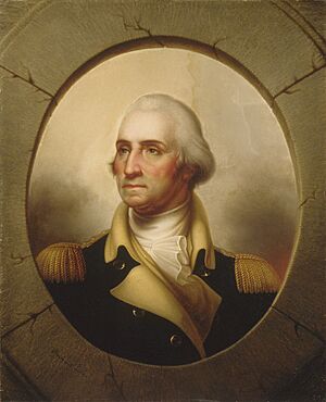
- George Washington (from Mount Vernon), the first President of the United States.
People in Entertainment
- Christina Hendricks, actress from Mad Men.
- Julianne Moore, an Oscar-winning actress.
- tobyMac, a Grammy-winning music artist.
- Jason Sudeikis, actor and writer from Saturday Night Live.
Musicians
- Dave Grohl, drummer for Nirvana and frontman for Foo Fighters.
- John Jackson, a blues guitarist.
Sportspeople
- Bruce Arena, a famous soccer coach.
- Mia Hamm, a U.S. Olympic and professional soccer player.
- Grant Hill, a former NBA basketball player.
- Ilia Malinin, a figure skater.
- Ed Moses, a U.S. Olympic swimmer.
- Alan Webb, a U.S. Olympic track runner.
Other Notable People
- Catherine Coleman, an astronaut.
- Kjell Lindgren, an astronaut.
- Sean Parker, co-founder of Napster.
Sister Cities
Fairfax County has special friendships with cities in other countries. These are called sister cities:
 Songpa (Seoul), South Korea (since 2009)
 Harbin, China (since 2009)
 Keçiören (Ankara), Turkey (since 2012)
Images for kids
See also
 In Spanish: Condado de Fairfax para niños
 | Audre Lorde |
 | John Berry Meachum |
 | Ferdinand Lee Barnett |


