Kingstowne, Virginia facts for kids
Quick facts for kids
Kingstowne, Virginia
|
|
|---|---|

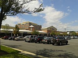
Shops and office building in Kingstowne, August 2015
|
|
| Country | United States |
| State | Virginia |
| County | Fairfax |
| Area | |
| • Total | 2.9 sq mi (7.5 km2) |
| • Land | 2.9 sq mi (7.4 km2) |
| • Water | 0.04 sq mi (0.1 km2) |
| Elevation | 200 ft (60 m) |
| Population
(2020)
|
|
| • Total | 16,825 |
| • Density | 5,889/sq mi (2,273.6/km2) |
| Time zone | UTC−5 (Eastern (EST)) |
| • Summer (DST) | UTC−4 (EDT) |
| ZIP code |
22315
|
| FIPS code | 51-42746 |
| GNIS feature ID | 2584862 |
Kingstowne is a special kind of community in Fairfax County, Virginia, United States. It's called a census-designated place (CDP). This means it's an area that looks like a town but isn't officially a city or town with its own local government.
Kingstowne is a planned community. This means it was carefully designed and built. It's located near big cities like Washington, D.C., and other towns such as Springfield and Alexandria. The main part of Kingstowne is around the intersection of South Van Dorn Street and Kingstowne Boulevard. In 2020, about 16,825 people lived there.
Kingstowne has a central area with shops and offices. The community includes many different types of homes. You can find apartments, condos, single-family houses, and townhomes here. Building in Kingstowne started in the 1980s and is still growing today. It even has its own ZIP code, 22315, which helps the U.S. Post Office deliver mail.
Where is Kingstowne?
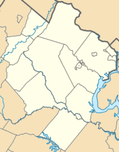
Kingstowne is located in the southeastern part of Fairfax County. It shares borders with several other communities. To the north and west, you'll find Franconia. Rose Hill is to the northeast.
To the southeast is Hayfield. Fort Belvoir is to the south. A small part of its southwestern edge touches Newington. The center of Washington, D.C. is about 13 miles (21 km) northeast of Kingstowne.
Land and Water
The Kingstowne area covers a total of about 7.5 square kilometers (2.9 square miles). Most of this area is land, about 7.4 square kilometers (2.9 square miles). A small part, about 0.1 square kilometers (0.04 square miles), is water. This means only a tiny portion, less than 2%, is covered by water.
See also
 In Spanish: Kingstowne (Virginia) para niños
 | Victor J. Glover |
 | Yvonne Cagle |
 | Jeanette Epps |
 | Bernard A. Harris Jr. |


